Skip to content
Already a Member?
Login
Login
Become A Member
Harbormaster Day
Best Harbor Contest
Contact Us
Search for:
Menu
Home
Massachusetts
Martha's Vineyard & Nantucket, MA
Nantucket, MA
Nearby Harbors
Eel Point, Nantucket, MA
Great Point, MA
Muskeget Island, MA
Wasque Point, Chappaquiddick Island, MA
Edgartown, MA
Dennis Port, MA
Harwich Port, MA
South Yarmouth, MA
Bass River, MA
Hyannis Harbor, MA
41.2857’ N, 70.0873’ W
Nantucket, MA
71°
H 73°
L 61°
W
10mph
Low tide
11:56 am
Photo Credits
Tides
Weather
Guide
Map
Directory
Boating
Fishing
Exploring Maps and Charts of Nantucket, MA
Chart View
Map View
Explore the Region
Explore the State
Featured Content
In The Zone: The Sabre 51 Salon Express
Learn More →
Coastal News Updates
See All
Jun 14, 2026
Meet The Great Marsh Shellfish Company, Oyster Growers in Massachusetts
Jun 11, 2026
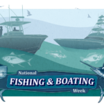
Celebrate National Fishing and Boating Week!
Jun 11, 2026
NOAA Fisheries Announces $2.3 Million to Study Atlantic Mackerel with the Northeast Fishing Industry