Skip to content
Already a Member?
Login
Login
Become A Member
Harbormaster Day
Best Harbor Contest
Contact Us
Search for:
Menu
Home
South Carolina
Charleston Harbor Area, SC
Charleston, SC
Nearby Harbors
Wappoo Creek, highway bridge, SC
Fort Sumter, SC
Elliott Cut entrance, SC
Clouter Creek, south entrance, SC
Breach Inlet, Isle of Palms, SC
I-526 bridge, SC
Folly River, SC
Parker Island, Horlbeck Creek, SC
Hamlin Sound, SC
Clouter Creek, north entrance, SC
32.7817’ N, 79.9250’ W
Charleston, SC
92°
H 96°
L 80°
S
13mph
High tide
4:28 pm
Photo Credits
Tides
Weather
Guide
Map
Directory
Boating
Fishing
Exploring Maps and Charts of Charleston, SC
Chart View
Map View
Explore the Region
Explore the State
Featured Content
In The Zone: The Sabre 51 Salon Express
Learn More →
Coastal News Updates
See All
Jul 23, 2026
2025 Species Recovery Grant Awardees Announced
Jul 22, 2026
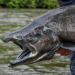
Shedding New Light on Yukon River Chinook Salmon Declines
Jul 21, 2026
Celebrating Habitat Month