Seal Bay on Vinalhaven is one of those areas of the chart that my eye is drawn to, and once there, lingers for awhile as I realize how much shoreline is packed into those inlets and how little of it I’ve seen. I’ve paddled through it a couple of times, but it seemed time for another visit, and with a mid-day high tide, I might be able to explore a cove or two.
Of course, getting there is half the story. Six or eight miles from downtown Stonington, Seal Bay is on the other side of East Penobscot Bay from me. If it were a little closer, this might have been a day trip. I headed west out of the Thorofare and pointed somewhere between Mark and Scraggy Islands at a slightly higher patch of shoreline a few miles away. The appeal of such crossings lies more in the imagination — the possibility of getting places — than it does in reality. You try to paddle a straight line, and just keep going. I thought about this and that, and tried to avoid looking at my watch. The wind and waves were bigger than I’d anticipated and, paddling a fairly unfamiliar boat, I had a few moments of doubt. But those moments passed. Less than two hours after leaving Stonington, I arrived at a point of land on Vinalhaven and slipped through the gap between Coombs Neck and Neck Island.
Right away I passed a few simple cabins, right on the water. They got my imagination working — it seems that you don’t see too many waterfront cabins that haven’t either been fixed-up or torn-down and replaced by zillion-dollar architectural marvels on their footprints. These look like they’ve been unchanged for awhile, except for one, which still looks like a boathouse, but with a nice place to hang-out on the deck. Perfect.
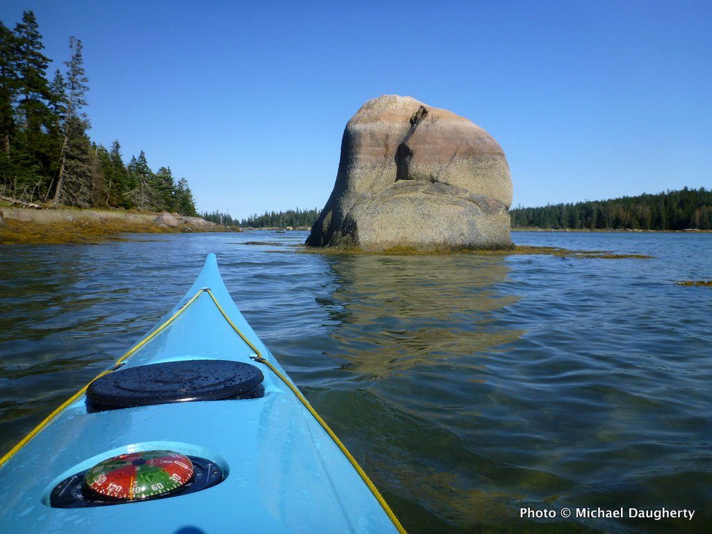
I followed the twists and turns of the easternmost cove and finally took a break on a ledge. The shoreline is probably all privately-owned, but it’s mostly undeveloped and wild. Smith Cove was much the same, just bigger — only a few houses on it. I could see Hay Island, where I planned on stopping for the night, but I wanted to check out as much of the bay as I could while the tide permitted. “Bay” seems a deceptive term for the body of water. It’s mostly very shallow, and as the afternoon went on, more and more ledge and mudflats were uncovered. At Burnt Island, I carried across the rocks barring the island to Vinalhaven.
I followed the shore to the west end, but with the water quickly draining, I didn’t want to get stuck, and headed back out along the shore of Penobscot Island. The area between Burnt and Hay islands is a popular anchorage — a hurricane hole sheltered from bigger winds on the outside. A few sailboats were anchored there as I found my campsite, and a couple more arrived as I explored the island and ate my dinner.
The night turned very dark and I sat out on the ledges for a while, until a shooting star flashed across the sky. I figured that must have been what I was waiting for, and turned-in. The forecast on the weather radio called for increased winds the next day, building to gale-force as a storm arrived. I resolved to get up and get going early, which is what I did.
I opened the gallery a few minutes late.
Click here to Explore Vinalhaven’s Seal Bay on the Interactive Map/Chart.
Photos of A Great Kayak Trip to Vinalhaven’s Seal Bay