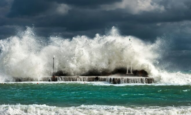
waves crash over the breakwater at high tide, boston skyline in distance

U.S. Coastal Sea Level Rise Rate Doubled in Past Century, New Study Finds

12/24/2025 - By Woods Hole Oceanographic Institution, whoi.edu. For harbor operators and coastal infrastructure planners, accurate sea level data is essential for making critical decisions about dock elevations, bulkhead construction, and long-term facility planning. A new scientific study highlighting significant acceleration in U.S. coastal sea level rise has important implications for harbors… SEE MORE
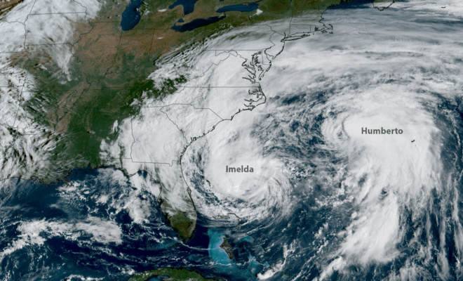
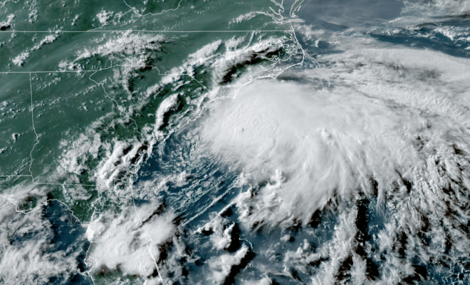
NOAA’s GOES-19 satellite captured images of hurricanes Imelda (left) and Humberto (right) churning off the U.S. East Coast on Sept. 30, 2025. (Image credit: NOAA Satellites)

2025 Atlantic Hurricane Season Marked by Striking Contrasts

11/30/2025 - By noaa.gov, noaa.gov. Seasonal activity fell within NOAA’s predicted ranges The 2025 Atlantic hurricane season, which officially ends on November 30, was notable for its striking contrast — wavering between periods of relative calm and bursts of intense activity, generating very powerful storms. Overall, the season fell within the predicted ranges… SEE MORE
Image Credits: NOAA.

Hurricane Erin Demonstrates Critical Maritime Coordination for Port Safety

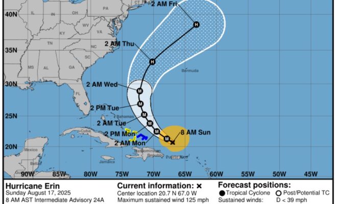
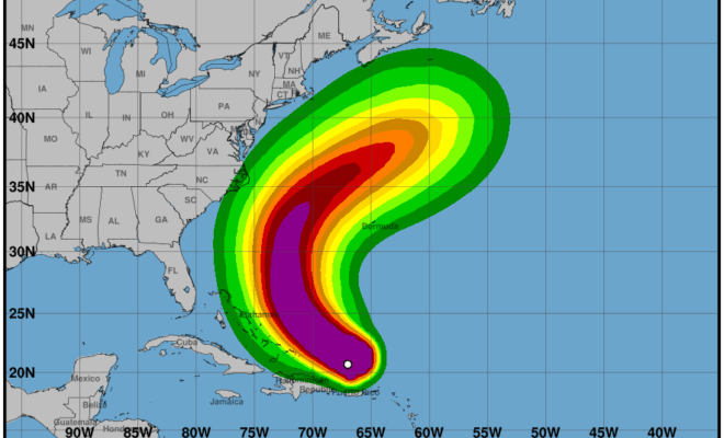
9/16/2025 - Hurricane Erin demonstrated how proactive federal coordination successfully protected East Coast ports and maritime traffic from distant storm threats. [caption id="attachment_51392" align="aligncenter" width="2560"] Image Credits: NOAA.[/caption] In “Hurricane Erin Demonstrates Critical Maritime Coordination for Port Safety” NOAA, published in noaa.gov. (Sep 10, 2025), it is stated: Hurricane Erin's passage near… SEE MORE
Image Credits: reasearch.noaa.gov.

NOAA and Partners Deploy Mini Ocean Robots to Collect Hurricane Data

9/4/2025 - By research.noaa.gov. The 4-foot-long robots aim to deliver low-cost data for research and forecasting. NOAA, in partnership with The University of Southern Mississippi and with the robotics company Oshen, launched five small uncrewed surface vehicles (USVs) called C-Stars in the waters off the U.S. Virgin Islands on August 31st to collect critical data… SEE MORE
Image Credits: NOAA.

Prediction Remains on Track for Above-Normal Atlantic Hurricane Season

8/19/2025 - By noaa.gov. As the 2025 Atlantic Hurricane Season enters its historical peak, atmospheric and oceanic conditions continue to favor an above-normal season as NOAA first predicted in May. Forecasters from NOAA’s National Weather Service updated the number of expected named storms to 13-18 (with winds of 39 mph or greater), of which… SEE MORE
Image Credits: NOAA.

Tropical Storm Erin Becomes First Atlantic Hurricane of 2025, Prompting Regional Port Closures

8/17/2025 - By UH Harbor. [caption id="attachment_51269" align="alignnone" width="2560"] Image Credits: Wikimedia Commons.[/caption] Key Takeaways from Hurricane Erin Advisory 24 (August 17, 2025) Immediate Threats (Today - Monday) Heavy Rainfall and Flooding Continued heavy rainfall across Virgin Islands and Puerto Rico today Risk of flash flooding, urban flooding, landslides, and mudslides Rainfall… SEE MORE
Image Credits: Getty Images.

Assessing the U.S. Temperature and Precipitation Analysis in July 2025

8/10/2025 - By ncei.noaa.gov. Record overnight warmth dominated the eastern U.S. in July and multiple regions across the country were impacted by flash flooding Key Point: Warm overnight minimum temperatures set July records, impacting more than 55 million people across the eastern states. In July, 1,434 flash flood warnings—the second-highest July total… SEE MORE
Image Credits: Pexels.

Mapping the Waters of Valdez, Alaska for Tsunami and Landslide Preparedness

7/31/2025 - By oceanservice.noaa.gov. A new partnership between NOAA and the City of Valdez, Alaska will help emergency managers prepare for future earthquakes, tsunamis, and underwater landslides. This partnership will support mapping 34 square nautical miles of the Port of Valdez — an important gateway to interior Alaska. A devastating earthquake in 1964 caused… SEE MORE