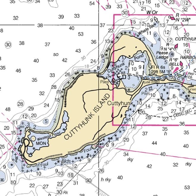
41.5929’ N, 70.9028’ W

Clarks Point, MA

64°
H -°
L 63°
SSE
4mph
High tide
9:38 pm

Clarks Point, MA Weather Forecast and Current Conditions

Day Sky High / Low Precip Wind Humidity
Sat
Sep 12
Partly Cloudy
Close Hourly
-º / 63º 12% SSE 7 mph 89%
9pm Clear 64º 2% SSE 4 mph 84%
10pm Mostly Clear 64º 2% SSE 4 mph 88%
11pm Partly Cloudy 64º 2% SSE 5 mph 88%
Sun
Sep 13
Thunderstorms
View Hourly
72º / 64º 100% S 13 mph 96%
12am Partly Cloudy 65º 2% SSE 6 mph 90%
1am Partly Cloudy 65º 3% SSE 6 mph 89%
2am Partly Cloudy 66º 3% SSE 6 mph 90%
3am Mostly Cloudy 66º 4% SSE 7 mph 90%
4am Mostly Cloudy 66º 9% SSE 7 mph 90%
5am Mostly Cloudy 67º 9% SSE 7 mph 92%
6am Cloudy 66º 12% SSE 7 mph 93%
7am Cloudy 67º 24% SSE 8 mph 91%
8am Showers 70º 52% SSE 8 mph 90%
9am Rain 71º 72% SSE 10 mph 90%
10am Thunderstorms 70º 98% SSE 11 mph 95%
11am Thunderstorms 70º 100% SSE 12 mph 97%
12pm Heavy Thunderstorms 70º 100% SSE 12 mph 98%
1pm Thunderstorms 71º 100% SE 13 mph 99%
2pm Thunderstorms 71º 81% S 12 mph 97%
3pm Thunderstorms 71º 64% SSW 10 mph 99%
4pm Scattered Thunderstorms 72º 37% SSW 9 mph 99%
5pm Cloudy 72º 19% SW 8 mph 96%
6pm Cloudy 72º 19% WSW 6 mph 96%
7pm Mostly Cloudy 70º 24% W 4 mph 99%
8pm Mostly Cloudy 69º 21% W 4 mph 100%
9pm Partly Cloudy 68º 21% W 4 mph 100%
10pm Mostly Cloudy 68º 23% W 4 mph 100%
11pm Mostly Cloudy 67º 17% W 4 mph 100%
Mon
Sep 14
AM Showers
View Hourly
75º / 50º 56% NNW 11 mph 63%
12am Mostly Cloudy 67º 24% W 4 mph 100%
1am Mostly Cloudy 67º 17% W 4 mph 99%
2am Partly Cloudy 67º 22% W 4 mph 99%
3am Mostly Cloudy 67º 24% W 5 mph 97%
4am Partly Cloudy 66º 17% W 5 mph 98%
5am Mostly Cloudy 66º 16% WNW 6 mph 98%
6am Mostly Cloudy 65º 19% NW 6 mph 98%
7am Showers 65º 46% NW 7 mph 96%
8am Showers 67º 56% NW 8 mph 87%
9am Mostly Cloudy 69º 17% NW 9 mph 79%
10am Partly Cloudy 69º 5% NW 10 mph 75%
11am Sunny 70º 3% NNW 11 mph 68%
12pm Sunny 72º 1% NNW 11 mph 58%
1pm Sunny 74º 1% NNW 11 mph 52%
2pm Sunny 74º 0% NNW 11 mph 47%
3pm Sunny 74º 0% NNW 11 mph 47%
4pm Sunny 74º 0% NNW 11 mph 46%
5pm Sunny 72º 0% N 11 mph 48%
6pm Sunny 70º 0% N 10 mph 52%
7pm Clear 67º 1% N 8 mph 56%
8pm Clear 64º 1% N 7 mph 61%
Tue
Sep 15
Mostly Sunny 70º / 55º 4% ENE 8 mph 64%
Wed
Sep 16
Partly Cloudy 73º / 61º 5% SSW 10 mph 71%
Thu
Sep 17
Partly Cloudy 76º / 63º 9% SSW 10 mph 77%
Fri
Sep 18
PM Showers 76º / 56º 36% WNW 11 mph 74%
Sat
Sep 19
Showers 68º / 58º 37% E 10 mph 70%

Weather Radar for Clarks Point, MA See Radar

* Playback displays weather for the past 6 hours.

NOAA Weather Marine Forecast for Clarks Point, MA

Tonight
Low : 66ºF
Mostly cloudy, with a low around 66. South wind 8 to 10 mph.
Sunday
High : 72ºF
Showers and thunderstorms before 4pm, then showers likely and possibly a thunderstorm between 4pm and 5pm, then a chance of showers and thunderstorms after 5pm. Some of the storms could produce heavy rainfall. High near 72. Southeast wind 10 to 13 mph. Chance of precipitation is 100%. New rainfall amounts between 1 and 2 inches possible.
Sunday Night
Low : 66ºF
Patchy fog. Otherwise, mostly cloudy, with a low around 66. North wind around 7 mph becoming west after midnight.
Monday
High : 72ºF
A chance of showers before 2pm. Mostly cloudy through mid morning, then gradual clearing, with a high near 72. Northwest wind 10 to 13 mph. Chance of precipitation is 30%. New precipitation amounts of less than a tenth of an inch possible.
Monday Night
Low : 58ºF
Mostly clear, with a low around 58. North wind around 11 mph.
Tuesday
High : 68ºF
Sunny, with a high near 68. North wind around 10 mph.
Tuesday Night
Low : 58ºF
Mostly clear, with a low around 58. East wind 5 to 8 mph becoming light and variable after midnight.
Wednesday
High : 70ºF
Sunny, with a high near 70. Southwest wind 5 to 11 mph.
Wednesday Night
Low : 64ºF
Mostly clear, with a low around 64. Southwest wind 6 to 9 mph.
Thursday
High : 73ºF
Sunny, with a high near 73. South wind 6 to 13 mph.
Thursday Night
Low : 65ºF
Partly cloudy, with a low around 65. Southwest wind 11 to 13 mph.
Friday
High : 72ºF
A chance of showers. Mostly sunny, with a high near 72. West wind around 15 mph becoming north in the afternoon. Chance of precipitation is 30%.
Friday Night
Low : 61ºF
A chance of showers. Mostly cloudy, with a low around 61. Northeast wind 9 to 11 mph. Chance of precipitation is 30%.
Saturday
High : 69ºF
Mostly sunny, with a high near 69. Northeast wind around 14 mph becoming southeast in the afternoon.

NOAA Buoy Data Near Clarks Point, MA See Map

Loading Map...
Loading Buoy Data...

    Wind Speed Forecast for Clarks Point, MA

    SundayMonday
    Wind Speed (MPH) 4671013844691111
    1am5am9am1pm5pm9pm1am5am9am1pm5pm9pm
    MPH 4671013844691111
    DIR SSESSESSESSESESWWWWNWNWNNWN

    Current Weather Conditions In Clarks Point, MA

    As Of: 19 minutes ago

    • 64ºF
    • 64ºF
    • 4mph
    • 0º (SSE)
    • 4mph
    • Clear
    • 10mi
    • 30.12"
    • 84%
    • 0ºF

    The weather right now in Clarks Point, MA is Clear. The current temperature is 64°F, and the expected high and low for today, Saturday, September 12, 2026, are -° high temperature and 63°F low temperature. The wind is currently blowing at 4 miles per hour, and coming from the South Southeast. The wind is gusting to 4 mph. With the wind and the atmosphere the temperature feels like 64° Fahrenheit. Expected precipitation is 2 percent, with current humidity at 84 percent, and air pressure at 30.12 in. Visibility is 10 nautical miles. There are 1 current weather alert(s).

    Weather Alerts
    Flood Watch - 1:18pm Sat Sep 12 2026

    ...FLOOD WATCH REMAINS IN EFFECT FROM LATE TONIGHT THROUGH SUNDAY AFTERNOON...

    WHAT: Flooding caused by excessive rainfall continues to be
    possible.

    WHERE: Portions of southeastern Massachusetts, including the
    following areas, Barnstable MA, Dukes MA, Eastern Plymouth MA,
    Nantucket MA, Northern Bristol MA, Southern Bristol MA, Southern
    Plymouth MA and Western Plymouth MA and Rhode Island, including the
    following areas, Block Island RI, Bristol RI, Eastern Kent RI,
    Newport RI, Northwest Providence RI, Southeast Providence RI,
    Washington RI and Western Kent RI.

    WHEN: From late tonight through Sunday afternoon.

    IMPACTS: Excessive runoff may result in flooding of rivers,
    creeks, streams, and other low-lying and flood-prone locations.
    Flooding may occur in poor drainage and urban areas.

    ADDITIONAL DETAILS: - Showers and a few embedded thunderstorms with localized narrow
    bands of torrential rainfall are possible very late tonight into
    Sunday afternoon. Widespread rainfall amounts of 0.50 to 2 inches
    are expected. However...localized narrow bands of 2-4" of rain
    are possible within a 3 hour period. While it remains uncertain
    if these narrow bands of heavier rain occur...the potential
    exists for localized flash flooding...especially if it were to
    occur over a vulnerable urban center.
    - http://www.weather.gov/safety/flood

    PRECAUTIONARY / PREPAREDNESS ACTIONS:

    You should monitor later forecasts and be alert for possible Flood
    Warnings. Those living in areas prone to flooding should be prepared
    to take action should flooding develop.

    &&