Tropical Storm Henri Could Track Close to New England With Wind, Rain and Storm Surge Impacts
Posted
Last Updated
By weather.com meteorologists
Tropical Storm Henri is expected to strengthen into a hurricane over the Atlantic, but its exact path and strength when it draws closer to New England are still uncertain.
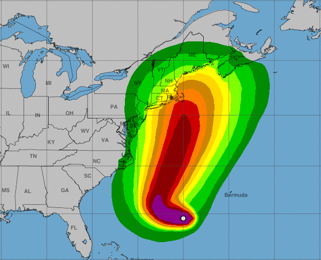
Residents of the Northeast U.S., especially New England and Long Island, should monitor Henri’s progress closely since it might bring wind, rain and storm surge impacts to parts of the region late weekend into early next week. Hurricane and/or tropical storm watches could be required for these areas by Friday.
Henri is located more than 800 miles south of Nantucket, Massachusetts, and is moving west at 10 mph.
The storm is somewhat disorganized right now because it’s battling wind shear and dry air.
Forecast Track, Intensity Uncertain
Henri is forecast to turn toward the northwest late this week, followed by a turn toward the north and eventually the north-northeast. This more northerly track will be influenced by the steering from a ridge of high pressure over the north-central Atlantic and an upper-level disturbance over the eastern U.S.
Some decrease in wind shear could allow Henri to intensify into a hurricane as it turns about and tracks off the East Coast into the weekend.
READ MORE at: https://weather.com/safety/hurricane/news/2021-08-19-hurricane-tropical-storm-henri-tracker