What are atmospheric rivers?
Posted
Last Updated
By noaa.gov
Learn more about these rivers in the sky
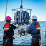
Atmospheric rivers are relatively long, narrow regions in the atmosphere – like rivers in the sky – that transport most of the water vapor outside of the tropics. These columns of vapor move with the weather, carrying an amount of water vapor roughly equivalent to the average flow of water at the mouth of the Mississippi River. When the atmospheric rivers make landfall, they often release this water vapor in the form of rain or snow.
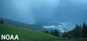
Although atmospheric rivers come in many shapes and sizes, those that contain the largest amounts of water vapor and the strongest winds can create extreme rainfall and floods, often by stalling over watersheds vulnerable to flooding. These events can disrupt travel, induce mudslides and cause catastrophic damage to life and property. A well-known example is the “Pineapple Express,” a strong atmospheric river that is capable of bringing moisture from the tropics near Hawaii over to the U.S. West Coast.

Not all atmospheric rivers cause damage; most are weak systems that often provide beneficial rain or snow that is crucial to the water supply. Atmospheric rivers are a key feature in the global water cycle and are closely tied to both water supply and flood risks — particularly in the western United States.
While atmospheric rivers are responsible for great quantities of rain that can produce flooding, they also contribute to beneficial increases in snowpack. A series of atmospheric rivers fueled the strong winter storms that battered the U.S. West Coast from western Washington to southern California from Dec. 10–22, 2010, producing 11 to 25 inches of rain in certain areas. These rivers also contributed to the snowpack in the Sierras, which received 75 percent of its annual snow by Dec. 22, the first full day of winter.
Read more at noaa.gov