By Patrick J. Lyons.
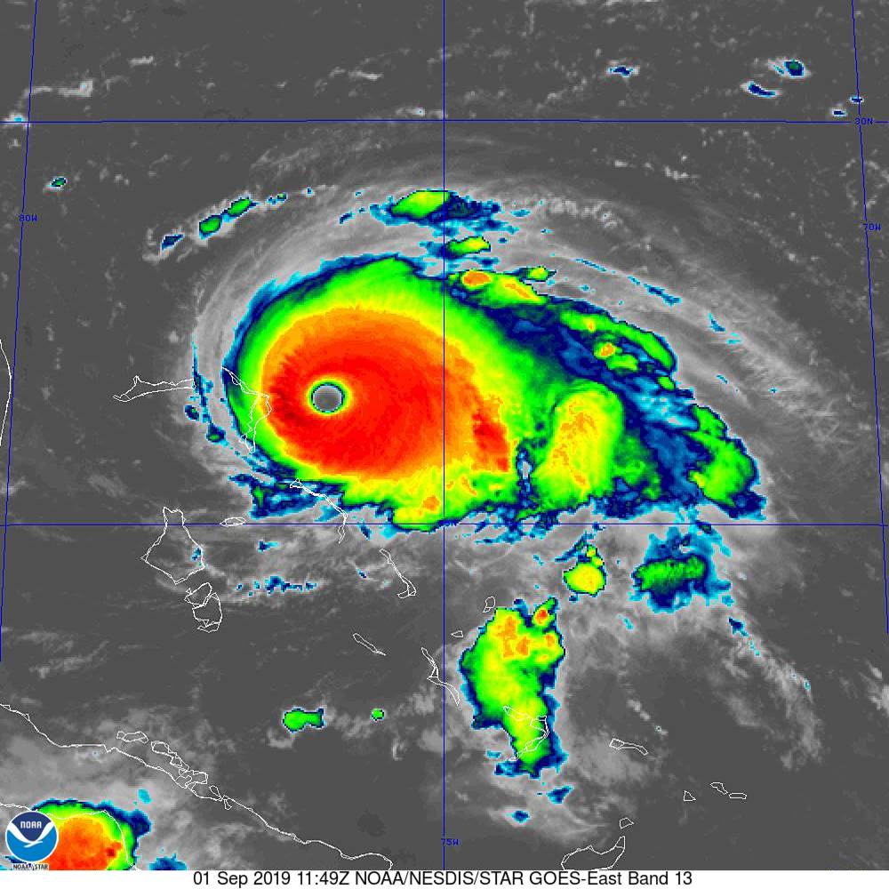
Dorian is expected to strike the northern Bahamas on Sunday and continue to menace the Florida coast. Dorian is now a Category 5 hurricane, the most powerful kind, according to the National Hurricane Center.
Storm reaches ‘catastrophic’ strength with 160 m.p.h. winds
As Hurricane Dorian drew near to the Abaco Islands in the northwestern Bahamas early Sunday morning, the National Hurricane Center said in a bulletin that the maximum sustained winds around the eye of the storm had reached 160- miles an hour, making it a “catastrophic” storm with “devastating winds.”
It is moving westward fairly slowly — 8 miles an hour — and would soon be moving over Great Abaco, and then continue near or over Grand Bahama later Sunday or early Monday, forecasters said. Storm surge as much of 15 to 20 feet was possible, enough to swamp many low-lying areas of the islands, and that as much as 25 inches of rain could fall before the storm passes.
NEW: #Dorian is now a category 5 #hurricane with 160 mph sustained winds. The eyewall of this catastrophic hurricane is about to hit the Abaco Islands with devastating winds. Next advisory: https://t.co/tW4KeFW0gB pic.twitter.com/oFspgN0XbT
— National Hurricane Center (@NHC_Atlantic) September 1, 2019
The storm is expected to turn northward, raking the coast
Forecasters expect the storm to creep nearer to the coast of Florida through Monday and then swing northward, paralleling the mainland coast. Though it may not make landfall all week if it follows that track, its strong winds and heavy rains, storm surge and punishing surf could still have the potential to do major damage in Florida, Georgia and the Carolinas.
READ MORE at nytimes.com

