Tropical Storm Fay Forecast to Make Landfall Along Mid-Atlantic
Posted
Last Updated
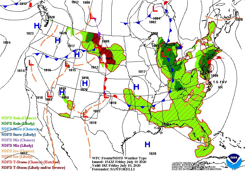
Tropical Storm Fay, currently located off the Mid-Atlantic coast is forecast to move northward and make landfall near New York City tonight. Impacts from Fay will extend across parts of the Mid-Atlantic into Southern New England including moderate to locally heavy rainfall and flash flood potential near and north of its track, gusty winds, and rough surf along the coast. Please refer to the National Hurricane Center for the latest on this system.
In the north-central U.S., one frontal system shifting across the Upper Midwest states today will trigger showers and thunderstorms across this region, with some remaining potential for flash flooding and strong to severe thunderstorms early this morning. Showers and storms will shift into the Ohio Valley and Southern states associated with a developing low pressure system across the Great Lakes and a wavy frontal system across the South during the next couple of days.
A second frontal boundary is exiting out of the northern Rockies into a warm and juicy airmass across the Plains. Showers and storms will develop along and ahead of the system. The Storm Prediction Center highlights a slight to enhanced risk for severe weather for this afternoon and evening across much of the northern Plains. Moderate to locally heavy rainfall may also accompany any developing storms.
Expansive upper level ridging will keep hot and above normal temperatures in place across much of the South. Temperatures over western Texas and eastern New Mexico may approach records for at least the next two days (and likely beyond). The Desert Southwest will be hotter still, with afternoon temperatures soaring into the 110s each afternoon. Above normal temperatures across southern Florida may also be near record values in a few locations. Above to much above normal temperatures are also expected to expand into the lower Great Lakes and interior New England as well. Heat advisories are in effect across much of the southern High Plains/Texas as well as the lower Great Lakes, with excessive heat warnings spanning across the Desert Southwest.
READ MORE at wpc.ncep.noaa.gov

