Saildrone Launches 72-foot Surveyor, Revolutionizing Ocean Seabed Mapping
Posted
Last Updated
By Saildrone.
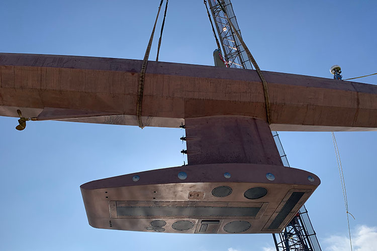
Less than 20% of Earth’s oceans have been mapped using modern, high-resolution technology—we know more about the topography of the Moon and Mars than we do about our own planet. And yet, knowing the shape of the seabed is critical to understanding ocean circulation patterns, which affect climate and weather prediction, tides, wave action and tsunami wave propagation, sediment transport, underwater geo-hazards, and resource exploration. Saildrone is excited to announce it has launched the Saildrone Surveyor, a new 72-foot uncrewed surface vehicle (USV) equipped for high-resolution mapping of the ocean seafloor.
The Surveyor carries a sophisticated array of acoustic instruments for both shallow and deep-water ocean mapping; the Kongsberg EM 304 multibeam echo sounder is capable of mapping the seafloor down to 7,000 meters below the surface. The Surveyor also carries two state-of-the-art Acoustic Doppler Current Profilers (ADCPs), the Teledyne Pinnacle 45 kHz ADCP and the Simrad EC150-3C ADCP, to measure ocean currents and understand what is in the water column. The Surveyor is also equipped with the Simrad EK80 echo sounder for fish stock assessments.
READ MORE at saildrone.com