SiriusXM Marine’s Fish Mapping gives users real-time information for fishing and weather conditions.
Fish Mapping helps you find the hot spots!
Serious offshore anglers rely on SiriusXM to take much of the guesswork out of fishing. The service recommends areas most likely to be active and gives anglers data they can use to help them find the edge when they’re offshore. Fish Mapping comes with all of SiriusXM Marine’s weather features plus these dedicated fishing features:
- Fishing Recommendations: View areas oceanographers recommend to help zero in on 6 target species
- Weed Lines: See the most recent sightings and track weed lines, which provide habitat for bait and game fish
- Sea Surface Height Info: Identify eddies, upwellings, and convergence zones with nutrient-rich water favorable for finding fish
- Sea Surface Temperature Info: View contour lines of sea surface temperature and ocean front strength to target areas where specific species of fish can be found
- Sub-Surface Water Temperature: Find the preferred temperature at 30 meters beneath the surface, where target game fish tend are likely to be hunting
- Plankton Concentrations and Plankton Fronts: See areas with dense plankton concentrations – bait fish feed on plankton and indicate locations to find game fish feeding activity.
The service is now available on Garmin, Simrad, and Furuno displays.
SiriusXM Marine offers a 1-month trial of Fish Mapping and All Access entertainment so you can see for yourself how it can help you on the water.
Related News
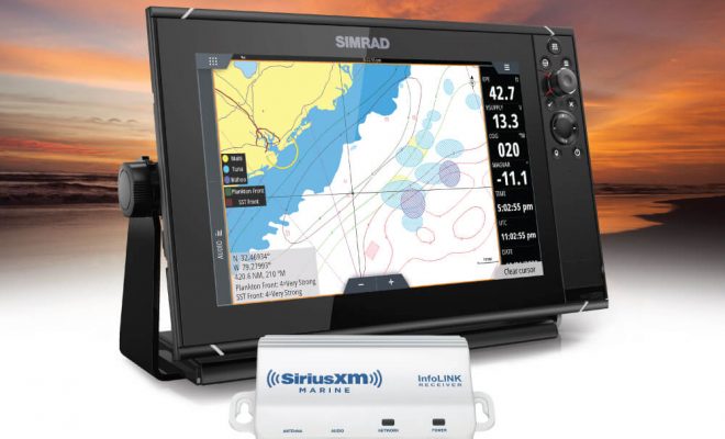
Fish Mapping: Now Available on Simrad!
Find the Spots Where the Fish Are! SiriusXM Marine’s Fish Mapping service is now available on Simrad NSO and NSS Evo3/3S displays via the WM-4 receiver. Whether you’re competing in a tournament, out fishing for fun, or taking clients on a charter trip, Fish Mapping provides the information you need… SEE MORE


