NOAA Scientists and Partners to Map Deep Waters, Seabed in the Cook Islands
Posted
Last Updated
By noaa.gov, noaa.gov.
This summer, NOAA Ocean Exploration will conduct an expedition on NOAA Ship Okeanos Explorer to map, explore and characterize deep waters off the coast of the Cook Islands. The effort is in partnership with the Cook Islands Seabed Minerals Authority.
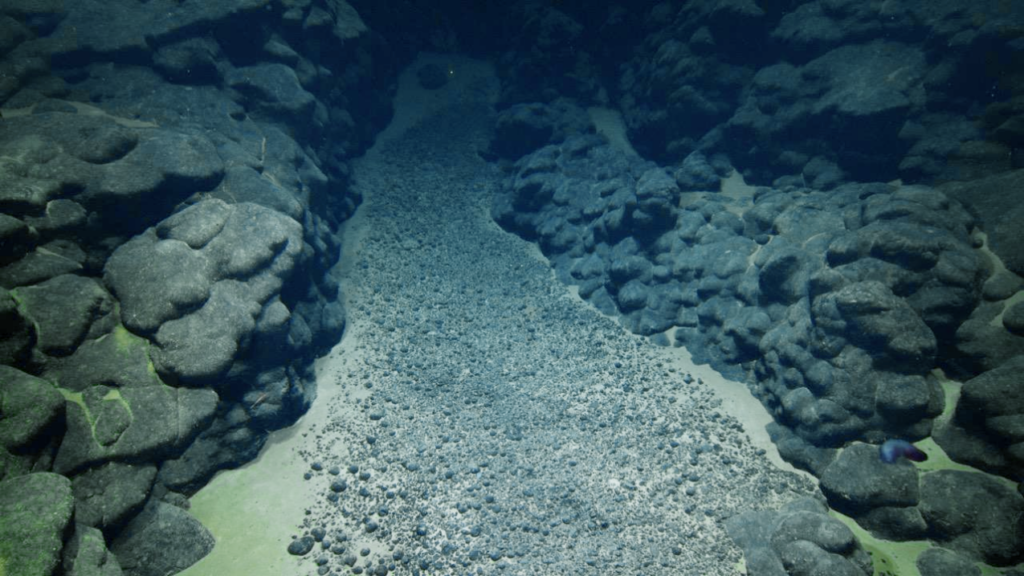
Using remotely operated vehicles (ROVs), mapping technologies and onsite sensors, the team will explore abyssal plains and the Manihiki Plateau. Operations will include imaging and sampling the seabed and water column to compare a variety of deep-ocean habitat types.
The 28-day expedition will take place in July and August 2026. While the expedition is underway, ROV operations will be streamed online in real time, enabling shore-based scientists and the public to watch live video from the deep sea and hear experts discuss what they see and learn.
Data gathered during the expedition will be made publicly available and shared with the Cook Islands government to support the management of marine resources in the region.
This work will build on a NOAA-funded 2025 expedition conducted in the Cook Islands on Exploration Vessel Nautilusoffsite link with the Cook Islands Seabed Minerals Authority and the Ocean Exploration Cooperative Institute.
“This expedition is a major step toward strengthening our strategic partnerships in the Pacific,” said Neil Jacobs, Ph.D., NOAA administrator. “NOAA is proud to contribute our world-class science and research to understand deep-sea resources, which will directly contribute to the economic growth of the United States and our partners, and will set the standard for responsible critical mineral management across the globe.”