Ida’s Remains Threaten Once-in-a-century Flood Event in Northeast
Posted
Last Updated
By Jeff Berardelli.
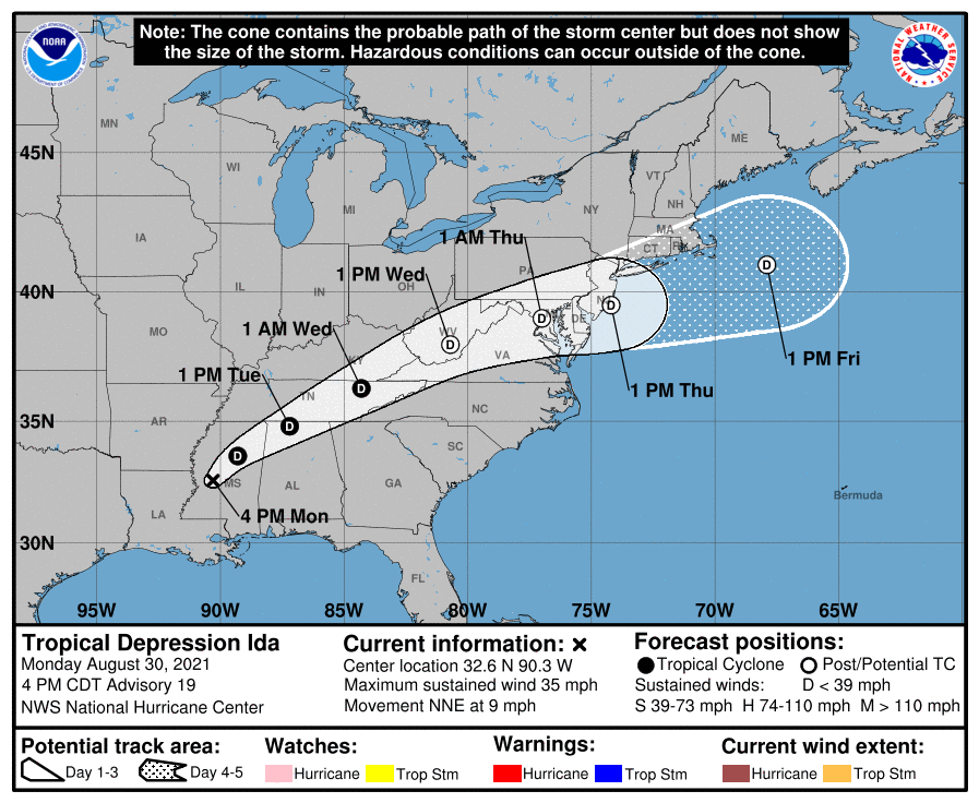
After slamming into Louisiana with 150 mph winds, Ida has weakened below tropical depression status. But even though the winds are gone, the threat for significant flash flooding remains as the system pushes northeast. In fact, that threat will only grow larger as the tropical moisture merges with a jet stream diving south from the Great Lakes.
The expectation for widespread 4- to 8-inch rainfalls across some parts of the Mid-Atlantic and Northeast has prompted the National Oceanic and Atmospheric Administration’s Weather Prediction Center to issue a rare “high risk” for torrential rainfall, warning that this could be a 1-in-100-year event for some areas.
Weather models are predicting 4 to 6 inches of rain over a widespread area, with isolated spots picking up over 8 inches. The heaviest rain looks to fall from the hills of northern West Virginia and Maryland, northeastward through Pennsylvania, northern New Jersey, southeastern New York and southern New England. This includes cities like Cumberland, Maryland; Harrisburg and Allentown, Pennsylvania; New York City and Hartford, Connecticut.
READ MORE at cbsnews.com