NOAA deploys drones in the ocean and atmosphere to advance hurricane forecasting
Posted
Last Updated
NOAA and partners are improving hurricane forecasting by harnessing the power of new technologies and working to coordinate these technologies to predict hurricane track, intensity, and rapid intensification.
Uncrewed systems and other tools are gathering data at different levels of the ocean and the atmosphere that are key to understanding how storms form, build, and intensify. Together with NOAA Hurricane Hunter aircraft carrying sensors, this data paints a clearer picture for scientists of the forces that drive hurricanes. Predicting these changes in hurricanes enables communities to better prepare, which can protect lives and property and strengthen local economies.
The goal of developing new systems is that the data collected can improve the representation of the ocean and atmosphere in hurricane forecast models. Data collected by NOAA Hurricane Hunter aircraft using existing observational tools, such as tail doppler radar and dropsondes, has already significantly advanced NOAA forecast models.
NOAA’s newest hurricane model will go into operation this season, the Hurricane Analysis and Forecast System. HAFS, NOAA’s next-generation hurricane model, aims to provide reliable forecast guidance on tropical cyclone track, intensity, and structure to NOAA’s National Hurricane Center. The model was jointly developed, tested, and evaluated by NOAA’s Atlantic Oceanographic & Meteorological Laboratory, NOAA National Weather Service’s National Centers for Environmental Prediction, and NOAA’s Cooperative Institute for Marine & Atmospheric Studies and the University of Miami.
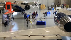
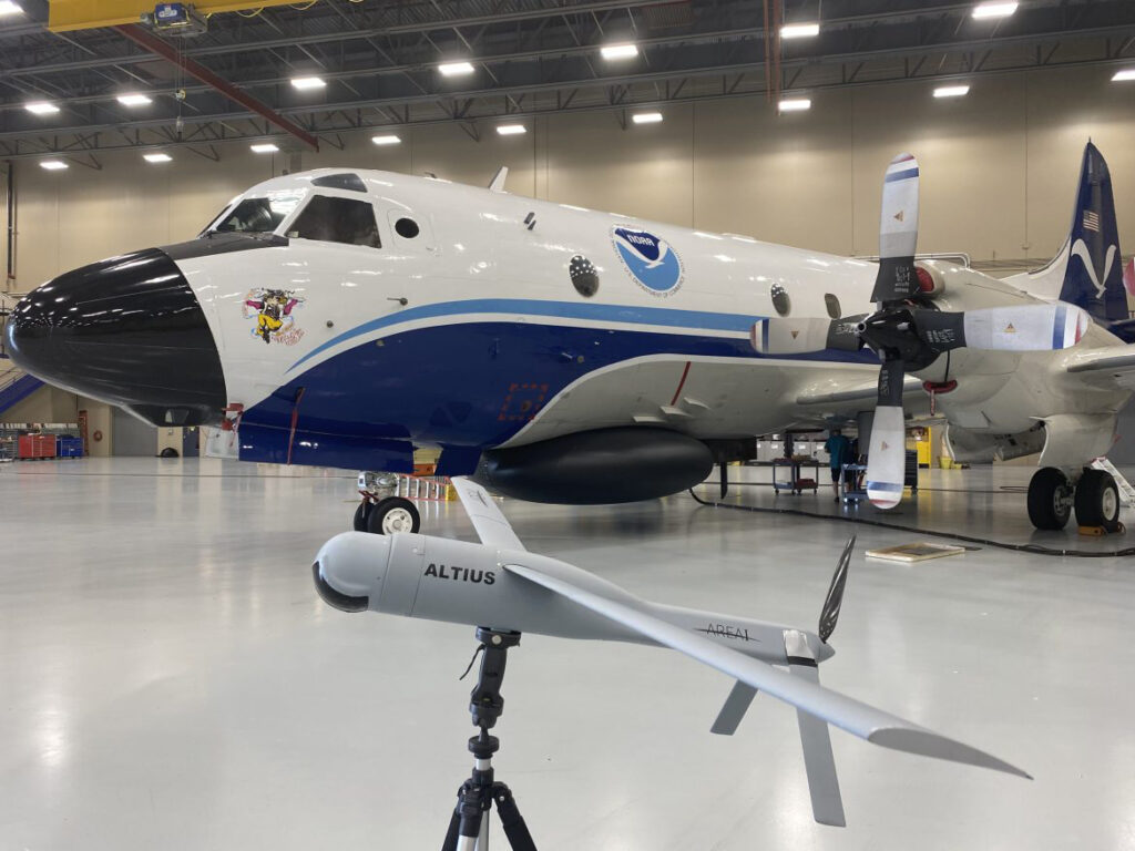
Here are some of the new technologies that are on display today at the kickoff event at Aircraft Operations Center in Lakeland, Florida. The new systems will complement and build upon the key observations already being collected by NOAA’s Hurricane Hunter aircraft and NOAA satellites.
Small Uncrewed Aircraft Systems
This spring, NOAA tested a small uncrewed aircraft system from Black Swift Technologies called the S0. The Blackswift S0 is a smaller, more lightweight uncrewed aircraft system than NOAA has used in the past with sensors that measure temperature, pressure and humidity. The tests were conducted from NOAA’s Aircraft Operations Center and are a critical step in ensuring that the instruments perform their data collection tasks in a safe and effective manner during hurricane season.
NOAA will also test the use of other small uncrewed aircraft systems, working with Andruil – Altius 600 which was flown into the eye of Hurricane Ian last year, and Dragoon, which offers a land-launched small uncrewed aircraft system..
New dropsonde will be deployed from Hurricane Hunter aircraft
NOAA will be deploying Streamsondes, a new lightweight weather dropsonde developed by Skyfora. Many of thes small systems can be released into a storm at once, providing valuable wind data.
These instruments will join traditional dropsondes and Airborne Expendable BathyThermographs, which have been deployed from NOAA aircraft for many years. Dropsondes are small instruments that collect profiles of atmospheric pressure, temperature, relative humidity, wind speed, and wind direction as they descend through the atmosphere. Airborne EXpendable BathyThermographs are small probes released from aircraft that measure ocean temperature as a function of depth as they descend through the water column.
Ocean surface and subsurface uncrewed systems
For the third year, NOAA and Saildrone Inc. will deploy Saildrones, uncrewed surface ocean observation platforms powered by solar, wind and wave energy, to track Atlantic hurricanes. These instruments provide information about the ocean and atmosphere, including sea surface temperature, salinity, surface air temperature, humidity, pressure, wind direction and speed, and wave height. Twelve saildrones, more than ever before, will be deployed this summer in the Atlantic Ocean, Caribbean and Gulf of Mexico, with several providing collocated observations alongside underwater gliders.
Read more at research.noaa.gov.