Northeast States Collaborate on Ocean Mapping Priorities, Garnering National Attention
Posted
Last Updated
By noaa.gov.
The Northeast Regional Data Prioritization Project, led by the Northeast Regional Ocean Council, is transforming how northeastern states handle coastal mapping. This initiative signifies a shift in regional data prioritization and mapping approaches, setting a collaborative precedent for coastal strategies nationwide.
Member states Connecticut, Maine, Massachusetts, New Hampshire, New York, and Rhode Island have harmonized their mapping strategies, pooling expertise to identify shared priorities and secure funding. Previously, individual state projects struggled to have their mapping needs met—but this collective effort has identified areas of common interest, led to five potential new project proposals, and influenced national priorities by engaging with the Integrated Ocean and Coastal Mapping program. This approach isn’t just about mapping; it’s addressing a spectrum of needs, from wind energy potentials to coastal hazards and archaeological sites, setting a new standard for comprehensive coastal understanding.
Identifying Priorities
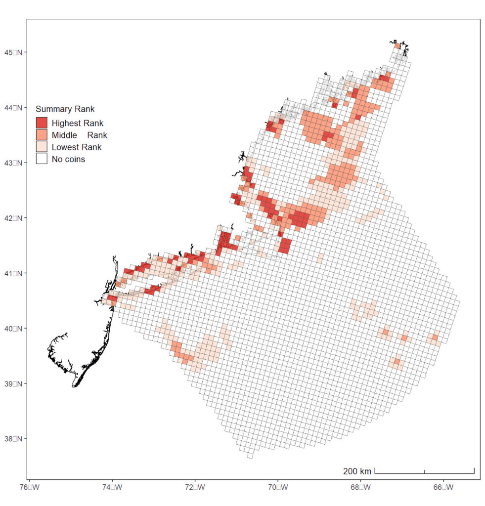
This project hinges on how priorities are identified and projects are chosen for action. Each participating stakeholder group, including states and national government agencies such as the National Marine Sanctuaries, National Park Service, and U.S. Geological Survey, received an allocation of 300 virtual tokens that were used to vote on priority mapping areas. This democratic allocation system helps pinpoint crucial hotspots and facilitates decision-making on where mapping efforts should be concentrated. The initiative involves the use of tools such as the SeaSketch tool and ArcGIS, empowering stakeholders to visualize data gaps and strategically allocate resources.
The Mapping Process
Mapping the ocean involves a variety of technologies and approaches based on the management needs and research questions to be addressed. In deeper, offshore waters this is usually accomplished through use of active sonar systems that operate by emitting sound and analyzing the returning echo. This provides bathymetry and seafloor hardness and roughness.