NOAA Releases First Images of Nodules from Waters Near American Samoa
Posted
Last Updated
By noaa.gov, noaa.gov.
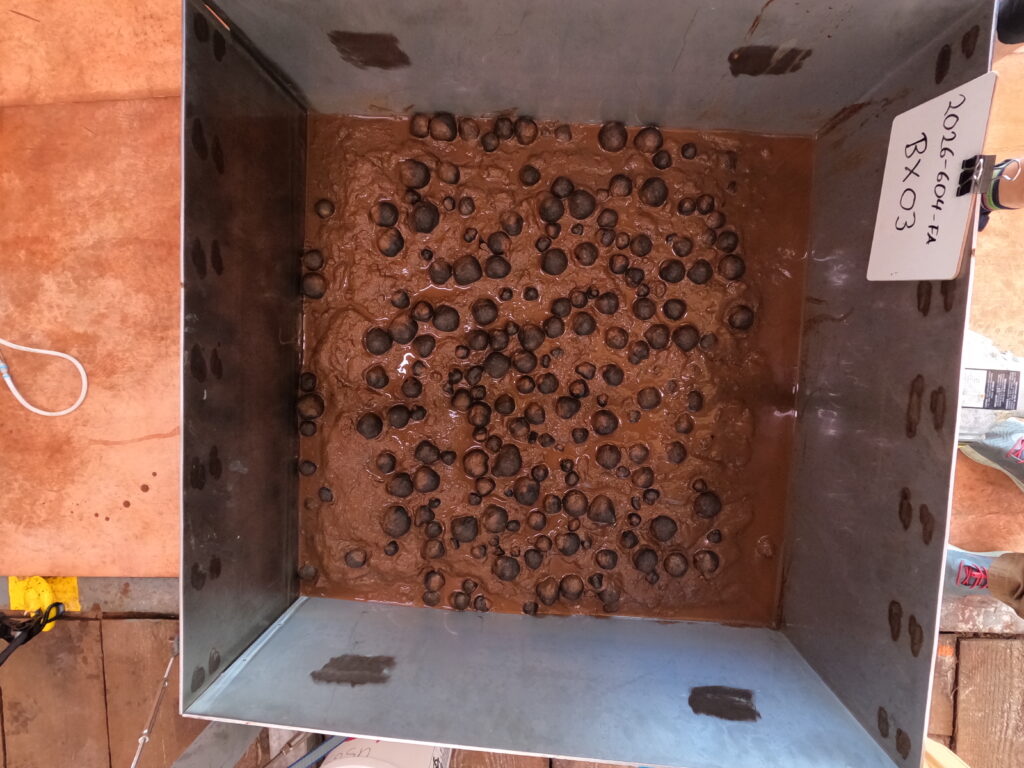
NOAA released today the first images of geologic seafloor samples from a hydrographic survey project to map and characterize more than 30,000 square nautical miles of federal waters in the U.S. exclusive economic zone (EEZ) beyond the territorial waters of American Samoa. The box core samples will allow for further analysis to understand the composition of deep sea resources and the environments in which they are found.
“NOAA’s mapping missions serve as a reminder that ocean exploration is a vital piece of our nation’s economic development,” said NOAA Administrator Neil Jacobs, Ph.D. “These images highlight the outstanding work of our NOAA team and partners to characterize the seafloor, and the data gathered during this historic project will enable science-based decision-making to support responsible development.”
The new images were collected as part of a Department of Commerce initiative to implement the U.S. Offshore Critical Minerals Mapping Plan as defined by President Trump’s Executive Order 14285: Unleashing America’s Offshore Critical Minerals and Resources. In developing the mapping plan, NOAA, in consultation with the Department of Interior’s Bureau of Ocean Energy Management (BOEM) identified the federal waters near American Samoa as a priority area of the seabed for mapping and analyzing nodules that may contain critical minerals.
“NOAA’s work to map and characterize these areas reflects the strength of interagency collaboration under President Trump’s Executive Order to unleash America’s offshore critical minerals,” said BOEM Acting Director Matt Giacona. “For BOEM, NOAA’s high-resolution mapping and characterization are essential inputs that will provide the foundational data needed to assess resource potential, inform leasing and environmental reviews, and reduce uncertainty as we evaluate future offshore mineral activities in a responsible, science-based manner.”
Read the full article here: NOAA Releases First Images of Nodules from Waters Near American Samoa
Originally published on April 17, 2026.