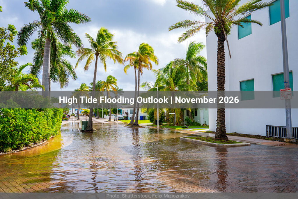
High Tide Flooding Outlook: November 2026
The strongest tides of the year arrive on the Pacific side this month. Higher tides can be expected around the new moon on November 9 and the full moon on November 24, a perigean full moon with the Moon at its closest to Earth, so the elevated water levels around it will persist for several days. Forty-nine of the fifty harbors on the list see their highest flood likelihood between November 22 and 28, most of them on the 25th. Using the National Ocean Service’s minor flooding threshold, measured against the Mean Higher High Water datum, 50 harbors show some chance of flooding this month, up from 43 in October, and seven of them reach a Greatest Chance (above 60%) where October had none. The West Coast dominates the outlook with 18 harbors, from San Diego to Puget Sound and the San Juan Islands, twelve of them new since October, and NOAA expects some West Coast and Hawaiian stations to exceed their flood threshold on the tides alone. Boston and Bar Harbor lead the Northeast with a Medium Chance (40–60%), Cape Canaveral and Fort Pulaski do the same for the Southeast, the Mid-Atlantic stays at a Slight to Medium Chance below 30%, and the Gulf Coast is quiet, down from eight harbors in October to three. A handful of Atlantic harbors, Kings Point, Norfolk and Cape Canaveral among them, also see a smaller chance around the new moon. Check the report below for harbors in your region.
National Summary
50 harbors have an elevated chance of high tide flooding in November 2026.
- Northeast7 harbors
- Mid-Atlantic8 harbors
- Southeast8 harbors
- Gulf Coast3 harbors
- West Coast18 harbors
- Hawaii6 harbors
Astronomical Factors
- Nov 9 — New moon
- Nov 24 — Full moon
National Summary
40 harbors have an elevated chance of high tide flooding in November 2026.
- Northeast4 harbors
- Mid-Atlantic9 harbors
- Southeast8 harbors
- Gulf Coast3 harbors
- West Coast12 harbors
- Hawaii4 harbors
Astronomical Factors
- Nov 9 — New moon
- Nov 24 — Full moon
Northeast 7 Harbors
Low lying areas may flood, however high tides alone will likely not cause a significant impact on the coast in most areas unless accompanied by a storm or strong winds. Lower than normal low tides will also occur.
| Harbor | Threshold (MHHW, ft)(MHHW, m)(MHW, ft)(MHW, m)(MSL, ft)(MSL, m)(STND, ft)(STND, m) | Flooding Likelihoods & Dates |
|---|---|---|
| Boston, MA | 2.05 ft0.62 m2.49 ft0.76 m7.12 ft2.17 m15.85 ft4.83 m | Medium ChanceNov 25–26 (peak 49.2%)Medium ChanceNov 24, 27 (25.6%–32.2%)Slight chanceNov 28 (8.8%–8.8%) |
| Bar Harbor, ME | 2.10 ft0.64 m2.52 ft0.77 m7.80 ft2.38 m16.94 ft5.16 m | Medium ChanceNov 26 (peak 45%)Medium ChanceNov 25, 27 (31.5%–32.1%)Slight chanceNov 24, 28 (8.4%–14.5%) |
| Kings Point, NY | 1.96 ft0.60 m2.32 ft0.71 m5.87 ft1.79 m22.64 ft6.90 m | Medium ChanceNov 24–26 (peak 33.7%)Slight chanceNov 6–8, 23, 27 (6.7%–16.8%) |
| Portland, ME | 2.04 ft0.62 m2.47 ft0.75 m7.00 ft2.13 m20.50 ft6.25 m | Medium ChanceNov 25–26 (peak 29.9%)Slight chanceNov 24, 27 (14.6%–15.1%) |
| Bridgeport, CT | 1.93 ft0.59 m2.27 ft0.69 m5.63 ft1.72 m11.23 ft3.42 m | Slight chanceNov 23–27 (peak 17.1%) |
| Providence, RI | 1.83 ft0.56 m2.08 ft0.63 m4.43 ft1.35 m10.16 ft3.10 m | Slight chanceNov 24–26 (peak 12.8%) |
| Newport, RI | 1.79 ft0.55 m2.04 ft0.62 m3.91 ft1.19 m7.54 ft2.30 m | Slight chanceNov 24–26 (peak 11.1%) |
Mid-Atlantic 8 Harbors
Minor tidal flooding along the coast will occur, particularly in low lying areas. If a storm occurs at this time, increased levels of tidal flooding and coastal erosion may occur. Lower than normal low tides will also occur.
| Harbor | Threshold (MHHW, ft)(MHHW, m)(MHW, ft)(MHW, m)(MSL, ft)(MSL, m)(STND, ft)(STND, m) | Flooding Likelihoods & Dates |
|---|---|---|
| Atlantic City, NJ | 1.82 ft0.56 m2.24 ft0.68 m4.21 ft1.28 m11.38 ft3.47 m | Medium ChanceNov 25–26 (peak 26.5%)Slight chanceNov 23–24, 27–28 (6.3%–17.6%) |
| Cape May Canal, NJ | 1.86 ft0.57 m2.29 ft0.70 m4.73 ft1.44 m9.72 ft2.96 m | Medium ChanceNov 25–26 (peak 23.9%)Slight chanceNov 23–24, 27–28 (7.3%–17.2%) |
| Sandy Hook, NJ | 1.85 ft0.56 m2.18 ft0.67 m4.50 ft1.37 m9.59 ft2.92 m | Medium ChanceNov 25 (peak 21%)Slight chanceNov 23–24, 26–27 (8.3%–19%) |
| New York (The Battery), NY | 1.84 ft0.56 m2.17 ft0.66 m4.33 ft1.32 m10.19 ft3.10 m | Medium ChanceNov 25 (peak 20.7%)Slight chanceNov 23–24, 26–27 (6.4%–16.2%) |
| Lewes, Breakwater Harbor, DE | 1.83 ft0.56 m2.25 ft0.69 m4.25 ft1.29 m9.26 ft2.82 m | Slight chanceNov 23–28 (peak 18.9%) |
| Norfolk, VA | 1.75 ft0.53 m1.96 ft0.60 m3.16 ft0.96 m8.89 ft2.71 m | Slight chanceNov 6–10, 23–28 (peak 13.5%) |
| Wachapreague, VA | 1.85 ft0.56 m2.17 ft0.66 m4.06 ft1.24 m8.65 ft2.63 m | Slight chanceNov 8–9, 23–27 (peak 13.3%) |
| Kiptopeke, VA | 1.76 ft0.54 m1.98 ft0.60 m3.27 ft1.00 m8.32 ft2.54 m | Slight chanceNov 24–26 (peak 6.8%) |
Southeast 8 Harbors
Some locations along the Southeast coast will have their highest tides of the year. Some stations along the Southeast coast are predicted to exceed the high tide flooding threshold based on tides alone. Minor tidal flooding along the coast will occur, particularly in low lying areas. If a storm occurs at this time, increased levels of tidal flooding and coastal erosion may occur. Lower than normal low tides will also occur.
| Harbor | Threshold (MHHW, ft)(MHHW, m)(MHW, ft)(MHW, m)(MSL, ft)(MSL, m)(STND, ft)(STND, m) | Flooding Likelihoods & Dates |
|---|---|---|
| Trident Pier, Cape Canaveral, FL | 1.76 ft0.54 m2.11 ft0.64 m3.81 ft1.16 m23.69 ft7.22 m | Medium ChanceNov 24–26 (peak 53.3%)Medium ChanceNov 23, 27 (24.1%–31%)Slight chanceNov 1, 7–10, 22, 28 (5%–13.7%) |
| Fort Pulaski, GA | 1.94 ft0.59 m2.31 ft0.70 m5.62 ft1.71 m12.94 ft3.94 m | Medium ChanceNov 25 (peak 44.1%)Medium ChanceNov 24, 26–27 (20.1%–38.2%)Slight chanceNov 8–9, 23, 28 (5.4%–11.9%) |
| Myrtle Beach (Springmaid Pier), SC | 1.86 ft0.57 m2.25 ft0.69 m4.75 ft1.45 m36.76 ft11.20 m | Medium ChanceNov 25–26 (peak 26.7%)Slight chanceNov 24, 27 (12.4%–13.6%) |
| Charleston, SC | 1.87 ft0.57 m2.23 ft0.68 m4.71 ft1.44 m10.40 ft3.17 m | Medium ChanceNov 25 (peak 23.3%)Slight chanceNov 23–24, 26–27 (6.2%–18.4%) |
| Fernandina Beach, FL | 1.90 ft0.58 m2.25 ft0.69 m5.17 ft1.57 m10.16 ft3.10 m | Medium ChanceNov 25–26 (peak 23.2%)Slight chanceNov 8, 23–24, 27 (5%–16.8%) |
| Duck, NC | 1.79 ft0.55 m2.11 ft0.64 m3.71 ft1.13 m24.06 ft7.33 m | Medium ChanceNov 25–26 (peak 22.3%)Slight chanceNov 8–9, 23–24, 27–28 (5.3%–16.3%) |
| Mayport Naval Station, St Johns R, FL | 1.83 ft0.56 m2.10 ft0.64 m4.32 ft1.32 m15.86 ft4.83 m | Slight chanceNov 24–27 (peak 16.6%) |
| Beaufort, NC | 1.78 ft0.54 m2.07 ft0.63 m3.61 ft1.10 m7.16 ft2.18 m | Slight chanceNov 24–26 (peak 8.4%) |
Gulf Coast 3 Harbors
In many locations of the Gulf Coast, the tidal range is relatively small compared to other regions of the U.S. so they will not be as significantly impacted by a perigean spring tide.
| Harbor | Threshold (MHHW, ft)(MHHW, m)(MHW, ft)(MHW, m)(MSL, ft)(MSL, m)(STND, ft)(STND, m) | Flooding Likelihoods & Dates |
|---|---|---|
| Eagle Point, Galveston Bay, TX | 1.62 ft0.49 m1.66 ft0.51 m2.14 ft0.65 m7.01 ft2.14 m | Medium ChanceNov 1, 9–10 (peak 24.8%)Slight chanceNov 2–8, 11–17, 22–29 (6%–18.9%) |
| Cedar Key, FL | 1.79 ft0.55 m2.13 ft0.65 m3.55 ft1.08 m7.40 ft2.25 m | Slight chanceNov 25–27 (peak 7.8%) |
| Bay Saint Louis, MS | 1.71 ft0.52 m1.85 ft0.56 m2.60 ft0.79 m5.86 ft1.79 m | Slight chanceNov 1, 25–26 (peak 5.6%) |
West Coast 18 Harbors
Some stations along the West Coast are predicted to exceed the high tide flooding threshold based on tides alone. Minor tidal flooding along the coast will occur, particularly in low lying areas. If a storm occurs at this time, increased levels of tidal flooding and coastal erosion may occur. Lower than normal low tides will also occur.
| Harbor | Threshold (MHHW, ft)(MHHW, m)(MHW, ft)(MHW, m)(MSL, ft)(MSL, m)(STND, ft)(STND, m) | Flooding Likelihoods & Dates |
|---|---|---|
| North Spit, Humboldt Bay, CA | 1.92 ft0.58 m2.63 ft0.80 m5.07 ft1.55 m23.32 ft7.11 m | Greatest ChanceNov 25–26 (peak 91.8%)Greatest ChanceNov 24 (77.4%–77.4%)Medium ChanceNov 23, 27 (42.3%–46.9%)Slight chanceNov 22 (5.4%–5.4%) |
| Los Angeles, CA | 1.86 ft0.57 m2.60 ft0.79 m4.52 ft1.38 m11.18 ft3.41 m | Greatest ChanceNov 24–25 (peak 90.6%)Greatest ChanceNov 26 (74.5%–74.5%)Slight chanceNov 23, 27 (6.3%–19.1%) |
| San Diego, CA | 1.87 ft0.57 m2.61 ft0.80 m4.65 ft1.42 m11.38 ft3.47 m | Greatest ChanceNov 24–25 (peak 85.4%)Greatest ChanceNov 26 (65.1%–65.1%)Slight chanceNov 23 (14.6%–14.6%) |
| Santa Monica, CA | 1.86 ft0.57 m2.60 ft0.79 m4.49 ft1.37 m9.72 ft2.96 m | Greatest ChanceNov 24–25 (peak 73.7%)Medium ChanceNov 26 (43.1%–43.1%) |
| Newport Harbor, Yaquina River, OR | 1.98 ft0.60 m2.67 ft0.81 m5.86 ft1.79 m14.89 ft4.54 m | Greatest ChanceNov 25 (peak 69.3%)Medium ChanceNov 24, 26 (55.6%–57.3%)Medium ChanceNov 27 (21.8%–21.8%)Slight chanceNov 23 (17.3%–17.3%) |
| La Jolla, CA | 1.85 ft0.56 m2.58 ft0.79 m4.45 ft1.36 m11.55 ft3.52 m | Medium ChanceNov 24–25 (peak 53.2%)Medium ChanceNov 26 (36.9%–36.9%) |
| Port Angeles, WA | 1.92 ft0.59 m2.47 ft0.75 m4.74 ft1.45 m39.30 ft11.98 m | Medium ChanceNov 25–26 (peak 53.2%)Medium ChanceNov 23–24 (21%–39.1%)Slight chanceNov 22, 27 (5%–16%) |
| Toke Point, Willapa Bay, WA | 2.00 ft0.61 m2.74 ft0.83 m6.14 ft1.87 m15.44 ft4.71 m | Medium ChanceNov 24–26 (peak 52.3%)Medium ChanceNov 23, 27 (30.9%–31.7%)Slight chanceNov 22, 28 (7.6%–8.8%) |
| Port Orford, OR | 1.88 ft0.57 m2.58 ft0.79 m5.23 ft1.59 m32.27 ft9.84 m | Medium ChanceNov 25 (peak 43.2%)Medium ChanceNov 24, 26 (22.9%–34%)Slight chanceNov 23, 27 (5.9%–7.1%) |
| Charleston, OR | 1.95 ft0.59 m2.61 ft0.80 m5.49 ft1.67 m13.33 ft4.06 m | Medium ChanceNov 24–26 (peak 36%)Slight chanceNov 23, 27 (10%–10%) |
| Point Reyes, CA | 1.87 ft0.57 m2.54 ft0.77 m4.53 ft1.38 m11.59 ft3.53 m | Medium ChanceNov 25 (peak 31.7%)Slight chanceNov 24, 26 (13.6%–17.2%) |
| Arena Cove, CA | 1.88 ft0.57 m2.55 ft0.78 m4.61 ft1.41 m36.68 ft11.18 m | Medium ChanceNov 25–26 (peak 30.9%)Slight chanceNov 24 (12.2%–12.2%) |
| Port San Luis, CA | 1.85 ft0.56 m2.56 ft0.78 m4.38 ft1.33 m11.43 ft3.48 m | Medium ChanceNov 25 (peak 29.9%)Slight chanceNov 24, 26 (8.2%–11%) |
| Monterey, CA | 1.85 ft0.56 m2.56 ft0.78 m4.36 ft1.33 m10.57 ft3.22 m | Medium ChanceNov 25 (peak 27%)Slight chanceNov 24, 26 (10.1%–18.1%) |
| Friday Harbor, WA | 1.95 ft0.59 m2.60 ft0.79 m5.16 ft1.57 m13.56 ft4.13 m | Slight chanceNov 25–29 (peak 19%) |
| Seattle, WA | 2.10 ft0.64 m2.96 ft0.90 m6.82 ft2.08 m21.39 ft6.52 m | Slight chanceNov 26–28 (peak 11.6%) |
| Cherry Point, WA | 2.01 ft0.61 m2.84 ft0.86 m5.87 ft1.79 m17.50 ft5.33 m | Slight chanceNov 26–29 (peak 10.8%) |
| Port Townsend, WA | 1.98 ft0.60 m2.66 ft0.81 m5.51 ft1.68 m13.86 ft4.22 m | Slight chanceNov 26–29 (peak 9.1%) |
Hawaii 6 Harbors
Some locations in the Pacific Islands will have their highest tides of the year. Some stations in the Pacific Islands are predicted to exceed the high tide flooding threshold based on tides alone. Minor tidal flooding along the coast will occur, particularly in low lying areas. If a storm occurs at this time, increased levels of tidal flooding and coastal erosion may occur. Lower than normal low tides will also occur.
| Harbor | Threshold (MHHW, ft)(MHHW, m)(MHW, ft)(MHW, m)(MSL, ft)(MSL, m)(STND, ft)(STND, m) | Flooding Likelihoods & Dates |
|---|---|---|
| Hilo, Hilo Bay, Kuhio Bay, HI | 1.00 ft0.30 m1.43 ft0.44 m2.25 ft0.69 m7.32 ft2.23 m | Greatest ChanceNov 25 (peak 86.4%)Greatest ChanceNov 24, 26 (72.3%–76.5%)Medium ChanceNov 27 (38.9%–38.9%)Slight chanceNov 23, 28 (6.1%–14.9%) |
| Kawaihae, HI | 1.00 ft0.30 m1.50 ft0.46 m2.19 ft0.67 m5.73 ft1.75 m | Greatest ChanceNov 25 (peak 84.7%)Greatest ChanceNov 24, 26 (71%–78.6%)Medium ChanceNov 27 (58.1%–58.1%)Medium ChanceNov 23 (26.8%–26.8%)Slight chanceNov 9, 28 (6%–16.6%) |
| Kahului, HI | 1.00 ft0.30 m1.35 ft0.41 m2.14 ft0.65 m5.66 ft1.73 m | Medium ChanceNov 25–26 (peak 38.7%)Slight chanceNov 24, 27 (8.8%–18.8%) |
| Nawiliwili, HI | 1.00 ft0.30 m1.40 ft0.43 m2.00 ft0.61 m5.11 ft1.56 m | Medium ChanceNov 25–26 (peak 29.4%)Slight chanceNov 24, 27 (8.8%–17.1%) |
| Mokuoloe, HI | 1.00 ft0.30 m1.32 ft0.40 m2.07 ft0.63 m6.04 ft1.84 m | Medium ChanceNov 25 (peak 29%)Slight chanceNov 24, 26–27 (6.3%–18.1%) |
| Honolulu, HI | 1.00 ft0.30 m1.46 ft0.45 m2.08 ft0.63 m6.71 ft2.04 m | Medium ChanceNov 25 (peak 21.5%)Slight chanceNov 24, 26 (11.5%–14.7%) |
Note: A harbor’s absence from this list does not mean flooding is impossible. It means NOAA either has no sufficiently validated model for that location, or the local hydrodynamics make a prediction unreliable. NOAA does not currently model any station in Alaska. Real-time weather can cause flooding at any coastal location regardless of this outlook — within five days, refer to the National Weather Service.
Where the risk is this month
Pin colour shows each harbor’s highest flood likelihood for the month. Select a pin for its dates and threshold.
Northeast 4 Harbors
Low lying areas may flood, however high tides alone will likely not cause a significant impact on the coast in most areas unless accompanied by a storm or strong winds. Lower than normal low tides will also occur.
| Harbor | Threshold (MHHW, ft)(MHHW, m)(MHW, ft)(MHW, m)(MSL, ft)(MSL, m)(STND, ft)(STND, m) | Flooding Likelihoods & Dates |
|---|---|---|
| Bridgeport, CT | 1.60 ft0.49 m1.94 ft0.59 m5.30 ft1.61 m10.90 ft3.32 m | Medium ChanceNov 24–26 (peak 38.5%)Slight chanceNov 6–9, 22–23, 27–28 (5.5%–18.2%) |
| Boston, MA | 2.23 ft0.68 m2.67 ft0.81 m7.30 ft2.23 m16.03 ft4.88 m | Medium ChanceNov 25–26 (peak 33.4%)Slight chanceNov 24, 27 (14.4%–19.2%) |
| Portland, ME | 2.10 ft0.64 m2.53 ft0.77 m7.06 ft2.15 m20.55 ft6.26 m | Medium ChanceNov 25–26 (peak 25%)Slight chanceNov 24, 27 (11.8%–12.1%) |
| Kings Point, NY | 2.20 ft0.67 m2.56 ft0.78 m6.11 ft1.86 m22.89 ft6.98 m | Medium ChanceNov 25 (peak 20.1%)Slight chanceNov 23–24, 26 (8.4%–17.8%) |
Mid-Atlantic 9 Harbors
Minor tidal flooding along the coast will occur, particularly in low lying areas. If a storm occurs at this time, increased levels of tidal flooding and coastal erosion may occur. Lower than normal low tides will also occur.
| Harbor | Threshold (MHHW, ft)(MHHW, m)(MHW, ft)(MHW, m)(MSL, ft)(MSL, m)(STND, ft)(STND, m) | Flooding Likelihoods & Dates |
|---|---|---|
| Cape May Canal, NJ | 1.25 ft0.38 m1.69 ft0.52 m4.13 ft1.26 m9.12 ft2.78 m | Greatest ChanceNov 24–27 (peak 70.5%)Medium ChanceNov 23, 28 (41.9%–42%)Medium ChanceNov 7–10 (24.1%–30.7%)Slight chanceNov 1–2, 5–6, 11–13, 22, 29–30 (5%–19%) |
| Atlantic City, NJ | 1.40 ft0.43 m1.81 ft0.55 m3.79 ft1.15 m10.96 ft3.34 m | Medium ChanceNov 24–27 (peak 59.8%)Medium ChanceNov 23, 28 (25.7%–27.7%)Slight chanceNov 1, 6–12, 22, 29 (6.3%–19.5%) |
| Lewes, Breakwater Harbor, DE | 1.35 ft0.41 m1.77 ft0.54 m3.77 ft1.15 m8.78 ft2.68 m | Medium ChanceNov 24–27 (peak 53.5%)Medium ChanceNov 23, 28 (28.8%–28.8%)Slight chanceNov 1–2, 6–12, 22, 29 (5.6%–19.8%) |
| Sandy Hook, NJ | 1.47 ft0.45 m1.80 ft0.55 m4.12 ft1.26 m9.21 ft2.81 m | Medium ChanceNov 24–26 (peak 49%)Medium ChanceNov 23, 27 (27.3%–27.4%)Slight chanceNov 6–10, 22, 28 (7%–16.5%) |
| Norfolk, VA | 1.75 ft0.53 m1.95 ft0.59 m3.15 ft0.96 m8.88 ft2.71 m | Slight chanceNov 6–10, 23–28 (peak 14.2%) |
| Kiptopeke, VA | 1.56 ft0.48 m1.79 ft0.55 m3.08 ft0.94 m8.13 ft2.48 m | Slight chanceNov 6–10, 23–27 (peak 14%) |
| Lewisetta, VA | 1.50 ft0.46 m1.64 ft0.50 m2.24 ft0.68 m7.77 ft2.37 m | Slight chanceNov 1–10, 23–25 (peak 8.4%) |
| Wachapreague, VA | 2.02 ft0.62 m2.34 ft0.71 m4.24 ft1.29 m8.82 ft2.69 m | Slight chanceNov 24–26 (peak 7.7%) |
| New York (The Battery), NY | 2.15 ft0.65 m2.47 ft0.75 m4.63 ft1.41 m10.49 ft3.20 m | Slight chanceNov 24–25 (peak 7.2%) |
Southeast 8 Harbors
Some locations along the Southeast coast will have their highest tides of the year. Some stations along the Southeast coast are predicted to exceed the high tide flooding threshold based on tides alone. Minor tidal flooding along the coast will occur, particularly in low lying areas. If a storm occurs at this time, increased levels of tidal flooding and coastal erosion may occur. Lower than normal low tides will also occur.
| Harbor | Threshold (MHHW, ft)(MHHW, m)(MHW, ft)(MHW, m)(MSL, ft)(MSL, m)(STND, ft)(STND, m) | Flooding Likelihoods & Dates |
|---|---|---|
| Charleston, SC | 1.24 ft0.38 m1.59 ft0.49 m4.08 ft1.24 m9.77 ft2.98 m | Greatest ChanceNov 25 (peak 81.6%)Greatest ChanceNov 24, 26–27 (63.6%–78%)Medium ChanceNov 7–9, 23 (40.1%–55.2%)Medium ChanceNov 1, 6, 10, 22, 28 (21%–38.4%)Slight chanceNov 2–5, 11–12, 29 (6.3%–18.5%) |
| Myrtle Beach (Springmaid Pier), SC | 1.40 ft0.43 m1.79 ft0.55 m4.29 ft1.31 m36.29 ft11.06 m | Greatest ChanceNov 25–26 (peak 69.8%)Medium ChanceNov 24, 27 (49.4%–53.1%)Medium ChanceNov 23, 28 (21.6%–28.2%)Slight chanceNov 6–10, 22, 29 (5.1%–18.1%) |
| Trident Pier, Cape Canaveral, FL | 1.76 ft0.54 m2.11 ft0.64 m3.81 ft1.16 m23.69 ft7.22 m | Medium ChanceNov 24–26 (peak 53.3%)Medium ChanceNov 23, 27 (24.1%–31%)Slight chanceNov 1, 7–10, 22, 28 (5%–13.7%) |
| Fort Pulaski, GA | 2.00 ft0.61 m2.37 ft0.72 m5.68 ft1.73 m13.00 ft3.96 m | Medium ChanceNov 24–26 (peak 39.6%)Slight chanceNov 8, 23, 27 (5%–16.1%) |
| Beaufort, NC | 1.46 ft0.45 m1.75 ft0.53 m3.29 ft1.00 m6.84 ft2.08 m | Medium ChanceNov 24–26 (peak 35.3%)Slight chanceNov 7–10, 23, 27–28 (7.1%–17.8%) |
| Duck, NC | 1.81 ft0.55 m2.13 ft0.65 m3.73 ft1.14 m24.08 ft7.34 m | Medium ChanceNov 25 (peak 20.4%)Slight chanceNov 9, 23–24, 26–28 (5.3%–18.6%) |
| Mayport Naval Station, St Johns R, FL | 1.79 ft0.55 m2.06 ft0.63 m4.28 ft1.30 m15.83 ft4.82 m | Slight chanceNov 23–27 (peak 18.9%) |
| Fernandina Beach, FL | 2.00 ft0.61 m2.35 ft0.72 m5.27 ft1.60 m10.26 ft3.13 m | Slight chanceNov 24–27 (peak 16.8%) |
Gulf Coast 3 Harbors
In many locations of the Gulf Coast, the tidal range is relatively small compared to other regions of the U.S. so they will not be as significantly impacted by a perigean spring tide.
| Harbor | Threshold (MHHW, ft)(MHHW, m)(MHW, ft)(MHW, m)(MSL, ft)(MSL, m)(STND, ft)(STND, m) | Flooding Likelihoods & Dates |
|---|---|---|
| Port Isabel, TX | 1.13 ft0.34 m1.18 ft0.36 m1.69 ft0.51 m6.35 ft1.94 m | Greatest ChanceNov 1, 24–26 (peak 72%)Medium ChanceNov 2, 8–14, 23, 27–28 (44.6%–57.2%)Medium ChanceNov 3, 6–7, 15–16, 22, 29 (24.5%–39.8%)Slight chanceNov 4–5, 17–18, 21, 30 (8.6%–15.9%) |
| Bay Saint Louis, MS | 1.46 ft0.45 m1.60 ft0.49 m2.35 ft0.72 m5.61 ft1.71 m | Slight chanceNov 1–2, 8–14, 23–28 (peak 15.7%) |
| Naples, FL | 1.50 ft0.46 m1.75 ft0.53 m2.72 ft0.83 m6.51 ft1.98 m | Slight chanceNov 24–26 (peak 6.9%) |
West Coast 12 Harbors
Some stations along the West Coast are predicted to exceed the high tide flooding threshold based on tides alone. Minor tidal flooding along the coast will occur, particularly in low lying areas. If a storm occurs at this time, increased levels of tidal flooding and coastal erosion may occur. Lower than normal low tides will also occur.
| Harbor | Threshold (MHHW, ft)(MHHW, m)(MHW, ft)(MHW, m)(MSL, ft)(MSL, m)(STND, ft)(STND, m) | Flooding Likelihoods & Dates |
|---|---|---|
| Los Angeles, CA | 1.50 ft0.46 m2.24 ft0.68 m4.16 ft1.27 m10.82 ft3.30 m | Greatest ChanceNov 23–27 (peak 100%)Slight chanceNov 22 (9.6%–9.6%) |
| Santa Monica, CA | 1.60 ft0.49 m2.34 ft0.71 m4.24 ft1.29 m9.47 ft2.89 m | Greatest ChanceNov 24–26 (peak 99.3%)Medium ChanceNov 23 (42.7%–42.7%)Medium ChanceNov 27 (25.8%–25.8%) |
| San Diego, CA | 1.80 ft0.55 m2.54 ft0.77 m4.58 ft1.40 m11.32 ft3.45 m | Greatest ChanceNov 24–25 (peak 93.2%)Greatest ChanceNov 26 (79.6%–79.6%)Medium ChanceNov 23 (27%–27%)Slight chanceNov 27 (5.5%–5.5%) |
| North Spit, Humboldt Bay, CA | 1.90 ft0.58 m2.61 ft0.80 m5.06 ft1.54 m23.30 ft7.10 m | Greatest ChanceNov 25–26 (peak 92.7%)Greatest ChanceNov 24 (79.1%–79.1%)Medium ChanceNov 23, 27 (44.6%–49.2%)Slight chanceNov 22 (6%–6%) |
| La Jolla, CA | 1.70 ft0.52 m2.43 ft0.74 m4.30 ft1.31 m11.39 ft3.47 m | Greatest ChanceNov 25 (peak 83.6%)Greatest ChanceNov 24, 26 (74.8%–77.8%)Slight chanceNov 23, 27 (9.1%–15%) |
| Port San Luis, CA | 1.70 ft0.52 m2.40 ft0.73 m4.23 ft1.29 m11.28 ft3.44 m | Greatest ChanceNov 25 (peak 64.5%)Medium ChanceNov 26 (40.7%–40.7%)Medium ChanceNov 24 (31.4%–31.4%)Slight chanceNov 23 (5.2%–5.2%) |
| Toke Point, Willapa Bay, WA | 2.10 ft0.64 m2.84 ft0.87 m6.24 ft1.90 m15.54 ft4.74 m | Medium ChanceNov 24–26 (peak 46.3%)Medium ChanceNov 23, 27 (25.7%–25.8%)Slight chanceNov 22, 28 (5.7%–6.6%) |
| Port Angeles, WA | 2.10 ft0.64 m2.64 ft0.81 m4.92 ft1.50 m39.48 ft12.03 m | Medium ChanceNov 24–26 (peak 38.9%)Slight chanceNov 23, 27 (8.8%–12.9%) |
| Friday Harbor, WA | 1.75 ft0.53 m2.40 ft0.73 m4.95 ft1.51 m13.36 ft4.07 m | Medium ChanceNov 25–28 (peak 32.8%)Slight chanceNov 29–30 (8%–14.7%) |
| Cherry Point, WA | 1.85 ft0.56 m2.68 ft0.82 m5.72 ft1.74 m17.34 ft5.29 m | Slight chanceNov 25–30 (peak 17.9%) |
| Arena Cove, CA | 2.01 ft0.61 m2.68 ft0.82 m4.74 ft1.44 m36.81 ft11.22 m | Slight chanceNov 25–26 (peak 16.5%) |
| Seattle, WA | 2.10 ft0.64 m2.97 ft0.90 m6.82 ft2.08 m21.40 ft6.52 m | Slight chanceNov 26–28 (peak 11%) |
Hawaii 4 Harbors
Some locations in the Pacific Islands will have their highest tides of the year. Some stations in the Pacific Islands are predicted to exceed the high tide flooding threshold based on tides alone. Minor tidal flooding along the coast will occur, particularly in low lying areas. If a storm occurs at this time, increased levels of tidal flooding and coastal erosion may occur. Lower than normal low tides will also occur.
| Harbor | Threshold (MHHW, ft)(MHHW, m)(MHW, ft)(MHW, m)(MSL, ft)(MSL, m)(STND, ft)(STND, m) | Flooding Likelihoods & Dates |
|---|---|---|
| Hilo, Hilo Bay, Kuhio Bay, HI | 0.90 ft0.27 m1.33 ft0.41 m2.15 ft0.66 m7.22 ft2.20 m | Greatest ChanceNov 24–26 (peak 96.8%)Greatest ChanceNov 27 (68.3%–68.3%)Medium ChanceNov 23, 28 (21.6%–38.9%)Slight chanceNov 9–10 (9.7%–12%) |
| Honolulu, HI | 0.70 ft0.21 m1.16 ft0.35 m1.78 ft0.54 m6.41 ft1.95 m | Greatest ChanceNov 24–26 (peak 95%)Greatest ChanceNov 27 (75.9%–75.9%)Medium ChanceNov 23 (50.9%–50.9%)Medium ChanceNov 28 (30.2%–30.2%)Slight chanceNov 8–10 (5.6%–14.4%) |
| Kahului, HI | 0.80 ft0.24 m1.16 ft0.35 m1.94 ft0.59 m5.47 ft1.67 m | Greatest ChanceNov 24–26 (peak 93.3%)Greatest ChanceNov 27 (67.2%–67.2%)Medium ChanceNov 23 (27.2%–27.2%)Slight chanceNov 9–10, 28 (9.1%–14.9%) |
| Nawiliwili, HI | 1.10 ft0.34 m1.51 ft0.46 m2.10 ft0.64 m5.22 ft1.59 m | Slight chanceNov 25–26 (peak 8.9%) |
Note: A harbor’s absence from this list does not mean flooding is impossible. It means NOAA either has no sufficiently validated model for that location, or the local hydrodynamics make a prediction unreliable. NOAA does not currently model any station in Alaska. Real-time weather can cause flooding at any coastal location regardless of this outlook — within five days, refer to the National Weather Service.
About this data
- Source
- NOAA Center for Operational Oceanographic Products and Services (CO-OPS), Monthly High Tide Flooding Outlook
- API
- Derived Products API (DPAPI), Daily Likelihoods endpoint
- Threshold
- NOS minor and NWS minor — both included
- Datum
- MHHW, MHW, MSL, STND — all included
- Units
- English (feet) and metric (metres) — both included
- Model run
- October 15, 2026
- Includes
- Harbors with at least one day at or above 5% flood likelihood
Flood likelihoods come from a probabilistic model combining tide predictions, sea level rise trends and seasonal changes in coastal sea level. The model does not account for real-time weather.