Boat Launches
Right in downtown Portland, the public boat ramp at East End Beach is convenient for those with small boats, kayaks, or paddle boards. Kayak and canoe storage is also available.
Anchorages
Diamond Island Roads, with depths of 40 to 45 feet, is the principal deepwater anchorage in the outer harbor. The anchorage eastward of Fish Point, called the 30-foot anchorage, has depths of 25 to 30 feet with lesser depths to 20 feet in the northeast part.
Excellent anchorage in 18 feet with good protection from all but easterly winds can be had in Diamond Cove, at the northeast end of Great Diamond Island. Anchor beyond the 16-foot contour to ensure adequate swinging room.
Hazards
There are several isolated dangers in the approaches to the harbor. West Cod Ledge (chart 13290), a 6.5-mile-long area of broken ground and isolated shoals, sets across the entrance from northeastward and southwestward. The most important and largest of the shoal areas are buoyed, and the deep natural channels between them afford a clear approach to the harbor in clear weather from several directions.
A second barrier of shoals extending from Ram Island Ledge to Cape Elizabeth is well buoyed. Several deep clear channels between them afford approach and entry well into the harbor for all vessels.
Note: Numerous large commercial vessels with limited maneuverability ply the harbor and should be given the right of way. Be watchful.
Tides and Currents
The mean range of the tide is 9.1 feet. The velocity at strength of the tidal current in the channel is about 1 knot southwest of Cushing Island and southwest of Diamond Island Ledge; within the harbor it is about 0.5 knot.
HARBORMASTER:
Located at the State Pier
(207) 772-8121, VHF 16
U.S. COAST GUARD:
Located in South Portland
(207) 767-0363, VHF 16
Wharves
Deepwater facilities at Portland include seven petroleum terminals, one general cargo terminal, and one international ferry terminal. All have highway connections and most have railroad connections. The alongside depths are reported; for information on the latest depths contact the operator. The other active facilities in the port are used as repair berths, and by fishing vessels, small craft, barges, tugs, ferries, and other miscellaneous craft.
On the north side of Fore River at Portland, State Pier, about 0.8 mile northeastward of Casco Bay Bridge, offers moorage for ferry, police boats, city fireboat and transient vessels.
Repairs
A boatyard at South Portland, about 0.7 mile north-eastward of the Casco Bay Bridge has three marine railways, the largest of which can handle craft up to 210 feet long, 1,200 tons displacement, and 16-foot draft for practically any type of repair work. There are also several ship repair firms in the port that have fully equipped machine, pipe, joiner, and welding shops and can handle above-the-water hull and engine repairs.
Small-Craft Facilities
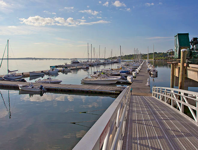
There are ample facilities in the port where all services can be obtained either at the piers on the Portland side of the river, or at the facilities on the South Portland side. The Centerboard Yacht Club in South Portland is between the Coast Guard base and the boatyard. The yacht club has a float landing with depths of 3 to 5 feet reported alongside. Water is available at the float. The public landing and boat ramp are 150 yards west of the abandoned lighthouse on the south entrance point to Fore River. The approach channel to the landing is marked by private seasonal buoys.
A marina in South Portland is in the cove entered northeastward of the Casco Bay Bridge; depths of 2 to 6 feet are reported alongside the berths. A 20-ton mobile hoist at the marina can handle craft up to 40 feet for minor engine repairs or dry open winter storage. A privately dredged and marked channel with a reported depth of 6 feet leads to the marina’s service float at which gasoline and diesel fuel can be obtained. A second marina is at the old shipyard, between Spring Point Ledge Light and Portland Pipe Line Corp. Pier 2. A depth of 8 feet is reported at the marina; a 35-ton mobile lift, gasoline, diesel fuel, storage facilities, a pump-out station and marine supplies are available. Hull, engine and electronic repairs can be made.
There are marinas with service piers at the old buoy depot on Little Diamond Island, Peaks Island, and several on the Portland waterfront from the State pier to the combination railroad and highway bridge.
There are also public landings at the State pier in Portland and at most of the State piers on the islands in Casco Bay.
Transportation Services
Passenger and freight ferries serve the nearby islands in Portland Harbor. Interstate bus lines offer transportation to all of the U. S. and Canada. Portland International Jetport is on the southwest side of the city.
Navigation
The main approaches to the harbor are from the southward from Portland Lighted Whistle Buoy P, or from the eastward from Halfway Rock Light to the entrance of the harbor between Portland Head, and Ram and Cushing Islands.
Prominent Features
- Portland Lighted Whistle Buoy P, is a large navigational buoy (LNB) about 5.3 miles east-southeast of Cape Elizabeth Light. The buoy is red, shows flashing and fixed white lights 42 feet above the water, and is equipped with a fog signal and racon.
- Cape Elizabeth, the southern entrance point of Casco Bay, is marked by Cape Elizabeth Light, 129 feet above the water, shown from a 67-foot white conical tower; the fog signal is about 266 yards southeast of the light. An abandoned lighthouse tower is about 300 yards to the southwest.
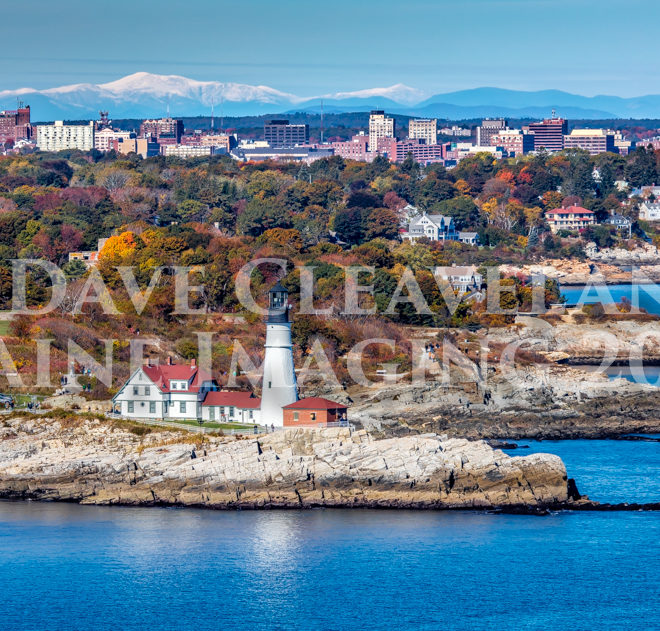
- Portland Head Light, 101 feet above the water, shown from an 80-foot white conical tower connected to a dwelling, marks the south side of the entrance. A fog signal is at the light.
Ram Island Ledge Light, 77 feet above the water, shown from a light gray conical, granite tower, is on the ledge, awash at low water, about 400 yards south of 27-foot-high Ram Island, and marks the north side of the entrance; a fog signal is at the light.
- Cushing Island, on the northeast side of the entrance, is mostly grass covered. White Head is a bluff at its northeastern end. A pier is in Spring Cove on the north side. Two old observation towers on the island are conspicuous. One is on White Head at the northeast end of the island; another is 500 yards southwest of it.
- House Island, also on the east side of the main channel, northwest of Cushing Island, is the site of the abandoned quarantine station. Old Fort Scammel on the southwest end is conspicuous, and the summit of the northeastern part of the island is marked by a house and flagpole. House Island Light 3, 20 feet above the water on a skeleton tower with a square green daymark, is on the north end of the island, and Fort Scammel Point Light 2, 35 feet above the water on a skeleton tower with a triangular red daymark, is on the south end.
- Spring Point is on the west side of the channel about 1.8 miles northwest of Portland Head Light. The buildings at Fort Preble on and southward of the point are conspicuous. A breakwater on the ledge, which extends about 300 yards northeastward of Spring Point, is marked at the end by Spring Point Ledge Light, 54 feet above the water, shown from a white conical tower on a black cylindrical pier. A fog signal is at the light.
- Fort Gorges, a conspicuous gray stone structure, is on Diamond Island Ledge, 0.8 mile northwestward of House Island. The ledge has a large area that uncovers, and a few spots bare at high water. Diamond Island Ledge Light marks the west end of the ledge. The south and east side of the ledge are marked by buoys. The wreck of an old schooner about 700 yards 018° from Fort Gorges is visible at low water.
- On the bluff above and westward of Fish Point on the north side of the entrance is the city of Portland. There are numerous conspicuous landmarks on the bluff and in the city, most of which are charted. One of the most conspicuous and historical is the old observatory tower that resembles a lighthouse.
Channels
The main entrance is from the southward, between Ram and Cushing Islands on the north and Portland Head on the south.
Whitehead Passage, between Cushing and Peaks Islands, has been updated on the NOAA charts indicating a ledge not previously marked. Please be advised that a recent chart should be used in this area. Please note: Charts on our website are to be used as a guide only. Our charts are not meant for navigation.
Diamond Island Pass, between Peaks Island and Little and Great Diamond Islands is marked only at its northeastern and southwestern ends, and is used by the smaller bay vessels and small craft. To carry the best water, pass 50 yards off the old and former Coast Guard buoy pier on Little Diamond Island and the wharf on the south end of Great Diamond Island.
A buoyed 22-foot channel westward of Great and Little Diamond Islands connects Hussey Sound with Portland Harbor.
A channel dredged to 15 feet and marked with daybeacons and buoys leads from the main channel in Fore River to the two mole-type piers of South Portland Coast Guard Base in South Portland, about 0.4 mile northeast of Casco Bay Bridge.
