Rising with the Tide: Keeping Our Communities Above Water Q&A
Posted
Last Updated
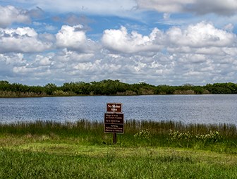
US Harbors recently hosted “Rising with the Tide: Keeping Our Communities Above Water”; a free conference for coastal communities. Our panel of experts included John Englander, Renee Collini, David Wolcott, Joseph Sutkowi, Gayle Bowness, Heiko Udluft and Nicole Elko.
During the conference we discussed pressing issues facing our coastal communities: sea-level rise; changing coastlines; how to approach risk assessment and plan adaptation; tidal monitoring and predictions.
The conference featured introductory remarks by Senator Angus King, and moderated by Anastasia Fischer, President, US Harbors.
Watch the full conference below:
PRESENTATION MATERIALS
AUDIENCE Q&A
We received a number of questions throughout the conference and our panelists have taken the time to research and respond below.
How much has sea level risen in the last 50 yrs, 10 yrs, 5 yrs. ?
- Renee Collini: Answering this question is not as straight forward as one would hope! First, it is very dependent on location – seas have risen in coastal Louisiana much more than they have say in parts of Alaska or even other parts of the Gulf of Mexico. You can go to the NOAA Sea Level Trends page and get an understanding of the current linear trend of rising seas and multiply that by the length of time that tide gauge has been there to get a conservative, or lowest, estimate of how much seas have risen. For example, if you go to that website and select Dauphin Island, AL it tells you there is currently a linear trend of 4.13 mm/yr based on data that covers 1966 – 2020. If you multiple 55 years times 4.13 mm/year you find that seas have risen an estimated amount of 227.15 mm or just under 9 inches (8.94 inches). This is a conservative estimate though because the recent acceleration in sea-level rise is slightly masked when you take a linear average across the entire period of record. You can use this though as a lowest or bare minimum estimate of how much seas have risen at a particular location over a given amount of time. Right now NOAA and NASA scientists are working on how to accurately capture the acceleration we’ve been seeing so that we have a better understanding of what the next 30 years of sea-level rise will look like. That will be in an upcoming technical report that will be released in late Dec or January.
- John Englander: It depends if you are looking at global average (GMSL-global mean sea level) or a particular location, which may vary dramatically due to land subsidence or uplift. Second, the rate is accelerating. 30 years ago GMSL was only 1.5 mm a year. Now the rate is over three times that. Similar to plotting the pandemic, the past does not show the future when things can change. At the current rate would have about a foot and half of GMSL this century. But the geologic shows that it has been as much as fifteen feet a century in the past.
Is the Pacific ocean rising more quickly than the Atlantic?
- Renee Collini: Different areas and coast lines are experiencing relative sea-level rise different based on changes in ocean currents, the way the ice sheets melt, and the vertical movement of the land at any given spot. In general, along U.S. coastlines I would say that right now the highest rates of relative sea-level rise can be found on the East and Gulf coasts. Though that is not a hard and fast rule. For example, American Samoa is still experiencing dramatic vertical land motion after a large earthquake that is causing them to see very high rates of relative sea-level rise.
- David Wolcott: The Earth’s crust is very dynamic and so vertical land motion is a huge driver of the inconsistencies of sea level rise around the world. And messaging this can be difficult because there are some things that are counterintuitive. For example, we know that areas in the northern parts of the continent (Canadian Side of Great Lakes for example) are rising due to isostatic rebound but that also impacts places like the Chesapeake Bay because the crust is kind of like a balloon; you apply pressure on one end you get a bulge at the other. You take that pressure away, you get a decrease in volume of air at the other. There are also hyperlocal impacts like fluid withdrawal from aquifers, oil drilling, etc that can impact relative sea level trends. Not sure if this answers the question but those are a couple of things to consider. There’s probably not a one-size-fits-all answer.
Roughly 13,000 years ago, global warming caused the great ice sheet covering North America to melt. The result is the topography we know today. Is this a naturally reoccurring weather cycle and if so what are the forces in play due to nature or due to man?
- John Englander: It’s useful to distinguish “weather cycle” like season rainfall, from changing climate, which is decades and longer. The “ice ages” have had a recurring natural cycle for the last 2.5 million years.For the last 11,000 years we have been in a rather stable climate period, referred to as the Holocene. Now we are in a era, departing from the pattern of the past. It’s generally referred to as the Anthropocene. The force of the ice age cycles is referred to as the Milankovitch Cycles, an up/down pattern roughly every hundred thousand years, caused by Earth’s changing orbit, tilt, and wobble, causing a variation in heat energy, somewhat like a giant summer-winter. The current rapid warming is a break out from that natural cycle, overpowering it by a factor of a hundred.
What are ‘king’ tides exactly?
- NOAA: A King Tide is a non-scientific term people often use to describe exceptionally high tides. Tides are long-period waves that roll around the planet as the ocean is “pulled” back and forth by the gravitational pull of the moon and the sun as these bodies interact with the Earth in their monthly and yearly orbits. Higher than normal tides typically occur during a new or full moon and when the Moon is at its perigee, or during specific seasons around the country.
- David Wolcott: As stated, it’s a term used by a lot of people but it doesn’t speak to any one specific process, more generally just higher than normal tides. While we can tie the term to perigean spring tides, there are actually other seasonal cycles and climatologies that we try to capture with our High Tide Flood Bulletin that would cause elevated water levels with some sort of predictability. And I suppose you could call any of the tides that are elevated during those times “king tides”.
What, if anything, can I do personally to slow erosion of our shoreline?
- Renee Collini: Depending on the kind of shoreline, green or nature-based shoreline protection measures are often very robust to erosion, though nothing is perfect. Additionally, not all systems are as well suited to those kinds of interventions. Finally, I would consider how you can reduce other, non sea-level rise related stressors. For example, boat wakes can be such an impact on coastal marshes that far exceed impacts from other processes like rising seas. Same thing for marine debris piling on to marshes minimizing their adaptive capacity. Doing what you can to help the natural shoreline be at its best adaptive capacity is a great start.
I would like to learn of sources of funding for planning to address inundation by sea-level rise and extreme weather events.
- Renee Collini: There are many sources out there through the federal government, including NOAA and FEMA. I would recommend reaching out to your local Sea Grant to see who on staff works on resilience and planning and they can connect you to not only federal, but state and local sources as well.
How can we incentivize and support sustainable financing for individuals as well as communities, states, national level?
- Renee Collini: This is a tough question and will require re-thinking how we apply current funding mechanisms and developing new ones. Right now there is an innovative revolving loan program with Congress to support individual homeowners in raising their homes using low-interest loans that stay with the property instead of the homeowner. That is one example of creative ways to finance individual efforts. There is also a community in North Carolina that has been able to leverage initial federal dollars for a buy-out program that has developed into a fully, in-house funded program. Lots of options for this! Just got to have conversations and get more people involved.
What kinds of changes to zoning ordinances have been made and what kind of resistance was faced (speaking specifically about Dauphin Island, AL)?
- Renee Collini: In terms of Dauphin Island specifically, a key thing they’ve been working on is zoning that will protect their dunes and their wetlands because there’s not a lot of place for the water to go so you need wetlands to stay in place and absorb it and they found that the core permitting agencies were using federal data sets which are coarse compared to the size of Dauphin Island and so wetland areas were being permitted as though they weren’t wetlands. They’ve gone and paid for a detailed study and are now implementing a much more robust set of restrictions on building that would impact wetlands. And then the other is for their dunes, they’ve increased the setbacks and how much you can build on them and go over them.
How do local governments initiate managed retreat planning?
- Renee Collini: I think it will look different for each location. I think it starts with using capital improvement funds or other funds to relocate or rethink where current critical facilities and other economic assets are located. It also takes someone being willing to build a coalition of residents, private sector, and public entities to have tough conversations and come up with a plan that has buy-in and is inclusive of the entire community – otherwise it won’t go far.
What is available in the way of studies or potential studies of specific low-lying areas along the Atlantic coast? These might include statistics regarding water level changes, effects of various mitigation techniques, and recommendations for threatened areas that are already developed? What resources do planning professionals and local planning officials have for determining reasonable actions or recommendations for permitting development of waterfront or low-lying areas?
- Renee Collini: I work primarily in the Gulf – but our Sea Grant teams are well versed in this. I would highly recommend starting there and with any local National Estuarine Research Reserve staff. Additionally, you could reach out to your local division of the Office for Coastal Management with NOAA who have many skilled professionals working on these topics as well.
What reasonable and sensible changes have been implemented in state and federal regulations regarding the process for private homeowners that want to protect their property from ocean rising.
- Renee Collini: It used to be you could only get money for things like elevating your home or relocation of a repetitive loss structure and we’ve seen changes now. We’re seeing more proactively they’re upping how much money you can get to elevate your home and it doesn’t have to be a repetitive loss structure anymore so hopefully we’re going to see people proactively minimizing damages. The same thing with buyout programs – it’s been really well acknowledged that buyout programs tend to focus on poor underserved communities while the infrastructure protection goes to wealthier and often white communities and because that’s now been acknowledged there’s now been an effort to strategically rethink it as a system and how some of those relocation efforts can be better done. Those are just a few examples and not a comprehensive coverage. I would also point to Florida’s efforts right now to support community planning that will ultimately lead to overall more resilient communities.
Property insurance costs can have a dramatic impact on future building plans. The reinsurance industry is often active in the background affecting the retail insurance that is available.
- Renee Collini: The federal government’s flood insurance program is becoming like a private insurer which means the influence of every insurer is growing as well. This does get back to some of those questions about just and equity but one way or another we’re going to have to start paying for the realities of our risk and now that we’ve gotten better modeling and we know that seas are rising and we have that data about where we’re heading, that risk will need to be considered and the cost of being insured for that risk. That will be influencing and that’s a big part of strategic retreat.
What do you call it when there is a storm that only allows for floods and no ebbing low tides in a harbor?
- David Wolcott: There is no specific name for this phenomenon that I have heard. The “flood” current associated with the storm surge exceeds the ebb current speed, causing a prolonged period of currents flowing in the flood direction. This is fairly common during times of peak storm surge close to landfall. Another example would be references to the Mississippi River flow reversing for a period of time during Hurricane Ida. – Paul Fanelli (NOAA)
In keeping track of water levels at NOAA gauges in Maine, we are seeing observed tides generally exceeding predicted tides (60-70% of the time), over and above what we’d expect due to “surge events”. Several questions: Are you observing this at other gauges as well? Do you think this is simply related to water levels actually running high, or is it due to the fact that the NTDE needs to be recalculated?
- David Wolcott: The mid point of the 1983-2001 EPOCH is 1992.5, that is 28.5 years from end of 2021. So with the EPOCH looking at a 19 year period it is valid that the values they are seeing for the separation between predicted and observed tides can be at that 60%. In addition to that you do have periods with tidal anomalies that can cause the standing water level to be elevated due to local meteorological and oceanographic conditions that can last weeks or years. So with that we are seeing this difference at most stations other than those in areas effected by GIA where the SLT is negative. And per the second question this is mostly due to the NTDE needing to be updated.
What percentage of the heating of the Earth is due to the same conditions that caused the glaciers to melt 13,000 years and what percentage is due to man’s activities today?
- John Englander: As referenced above, the melting / warming 13,000 years ago was the most recent upward phase of the ice age cycles. That cycle would now almost certainly be entering the 80,000 year cooling phase, heading to the next ice age. The warming caused by the 40% increase in troposheric “greenhouse gases” has overpowered the natural cooling phase by roughly a hundred times. So while the Earth does have natural heating and cooling cycles over tens of thousands of years, essentially all of the current rapid warming is the result of human activity.
If you have additional questions for our experts please email us at [email protected]