The Coast Is Clear-er: NOAA Unveils New Land Cover Maps 900 Times Greater In Detail
Posted
Last Updated
By noaa.gov, noaa.gov.
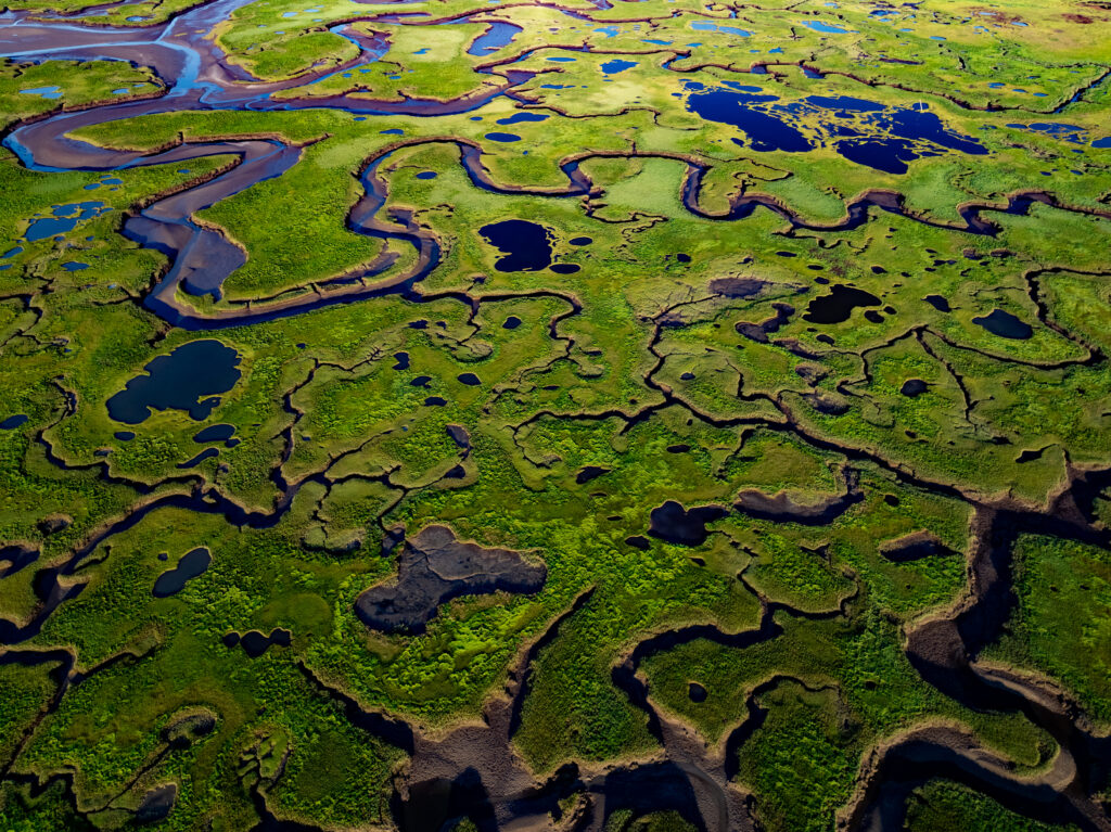
NOAA is releasing new, higher-resolution land cover maps for coastal Alabama, Mississippi, Northeastern Ohio, Rhode Island, and the Puget Sound in Washington. The data will be made available through the Digital Coast website and will provide these communities with better information for decisions related to stormwater management, water quality assessments, urban heat and tree canopy/cover projects, wetland restoration, modeling, flood mitigation and more.
The new mapping represents a large jump in visual resolution, from 30 meters to 1 meter, and is 900 times more detailed than what was produced 10 years ago. The greatly enhanced platform can help decision-makers in the U.S. document key geographic and landscape features at various locations on the Earth’s surface. By comparing maps from one year to another, communities can track how their land use is changing.
“This high-resolution land cover data is a powerful new tool for science-based decision-making,” said Nicole LeBoeuf, assistant administrator of NOAA’s National Ocean Service. “The information – which is 900 times greater in detail – gives local planners the precision needed to assess critical risks, such as water quality and storm protection, and to identify priority wetlands for preservation so they can meet local challenges head on.”
")
Land cover maps document on-the-ground features, from forests and wetlands to impervious surfaces, like buildings and roads. They are some of NOAA’s most used datasets. Coastal management and land use planners depend upon this information for evaluating landscape features, from forests and wetlands to sealed surfaces such as buildings and roads. This newest update will provide up to 20 land cover categories, including a variety of wetland types.