NOAA and Honeywell to explore use of HALAS upper-air data to aid in weather forecasting
Posted
Last Updated
By weather.gov.
February 7, 2024 – NOAA’s National Weather Service and Honeywell Aerospace Technologies signed a two-year Cooperative Research and Development Agreement to deploy a high-altitude LiDAR Atmospheric Sensing (HALAS) ground system and to evaluate the upper-air data gathered to determine if it could aid in weather forecasting.
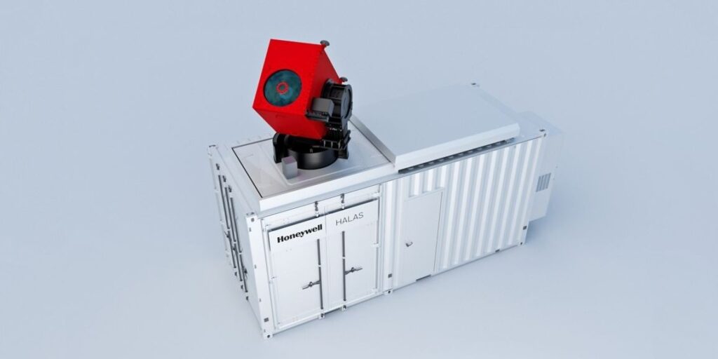
Honeywell’s HALAS ground system uses a rapid series of laser pulses to provide near real-time atmospheric measurements. HALAS enables forecasters to obtain weather data up to 100,000 feet above the surface of the Earth, though NOAA meteorologists intend to focus on data below 40,000 feet, where aircraft fly and the atmosphere is more dynamic. HALAS will gather observations including atmospheric pressure, temperature, humidity and wind speed and direction, similar to weather balloons.
“Understanding the atmosphere above the surface is vital to predicting the evolution of weather phenomena, from local afternoon thunderstorms to expansive blizzards and hurricanes,” said Jordan Gerth, meteorologist, National Weather Service Office of Observations. “This research project could help us identify a new way to gather the observations we need, more readily.”
“Honeywell’s high-altitude LiDAR atmospheric sensing (HALAS) is a remotely-operated, ground-based weather information system that provides near real-time, high-altitude atmospheric measurements in as little as three minutes,” said Matt Picchetti, VP & GM, Navigation and Sensors, Honeywell Aerospace Technologies.
Under the CRADA, NOAA and Honeywell will:
- Evaluate the utility of the HALAS ground system for NOAA’s observational needs, particularly as an operational observation in support of the National Weather Service.
- Develop an onsite demonstration of the HALAS system for data analysis and assessment.
- Explore value creation, cost savings, data rights and sharing models if a long-term network of HALAS systems can meet NOAA’s mission.
read more at weather.gov.