Upgrade will help communities anticipate impacts, risks, and supports planning and response.
NOAA’s Sargassum Inundation Risk tool (SIR) has been upgraded to offer daily reports on the location and risk that brown floating algae could wash ashore along coastal areas in the Caribbean, Florida, Gulf of America, and northern South America. The SIR now provides a daily report with a resolution of approximately a half mile (one kilometer). Previously these reports were issued weekly with a resolution of three miles (five kilometers).
This more detailed information can be used by the public, fishermen, and communities to anticipate impacts and take mitigation measures, including planning vacations, fishing activities, and seaweed cleanup operations for the shoreline.
“We are now at the beginning of the season when sargassum is growing in the ocean and the risk is increasing that it may be carried by winds and currents ashore,” said Matthieu Le Henaff, an oceanographer at NOAA’s Atlantic Oceanographic and Meteorological Laboratory who oversees the SIR. “Our updated risk tool is now more timely and the higher resolution offers more detail on where sargassum is and where it is not.”
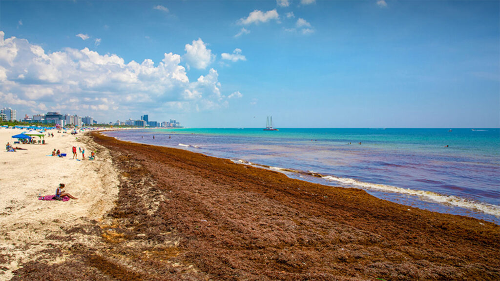
Sargassum on the shoreline has become a major nuisance and an economic drain on communities, affecting tourism in the spring and summer seasons. While sargassum is a naturally-occurring algae that can benefit the marine ecosystem in many cases, it’s another story when large mats of sargassum wash ashore and begin to rot in the hot sun. Decaying sargassum can give off hydrogen sulfide gas that can potentially affect human and animal health by irritating the eyes, nose, and throat.