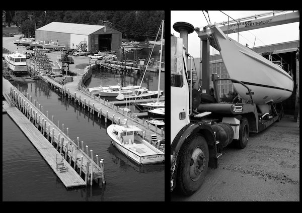
The town wharf and float landing, just eastward of the Academy wharf, has 12 feet reported alongside. A boatyard is 150 yards northeast of the town wharf. A 20-ton marine railway at the yard can handle craft up to 45 feet long for hull or engine repairs or dry open and covered winter storage; gasoline, diesel fuel, water, ice, and some marine supplies are available.
Castine Yacht Club, about 100 yards eastward of the boatyard, has a depth of 8 feet reported alongside its float landing. The stone foundation of an old stone pier is between the shore and the northeast end of the yacht club float; care should be taken to avoid it in coming alongside.
Small craft anchor off the town eastward of the float landings, where there are a number of moorings, but the best anchorage is reported to be in Bartlett (Smith) Cove, southeastward of Castine Harbor. The cove has depths of 19 to 58 feet, soft bottom, and shelter can be found there in all winds.
Another small-craft anchorage is in what is locally known as Hospital Cove between Nautilus Island, Holbrook Island, and Ram Island and the northern extremity of Cape Rosier. This cove can be entered from the westward through the channel between Nautilus Rock, marked by a buoy, and Holbrook Island. The southwesterly channel, between Ram and Holbrook Islands and Cape Rosier, is unmarked and more difficult. Anchorage, secure in all weather, can be had in good holding ground in 13 to 37 feet in the westerly half of the cove. The holding ground in the channel southeastward of Castine is not good, and the general depth is about 72 feet.
Navigation:
Click the “Map View” button above to see a chart of this harbor.
The Bagaduce River empties into the eastern side of East Penobscot Bay near its head. The river is the approach to the town of Castine, on the north side just inside the entrance, and to several smaller settlements farther up.
Castine Harbor, at the entrance to the river, has ample depth and is easily entered. The white stone circular tower of Dyce Head Light, formerly abandoned but now once again in use as an aid to navigation after microbursts destroyed the daymarker, is very conspicuous.
Craft entering Castine Harbor will find the eastern shore northward and southward of the entrance is bold and can be followed at a distance of 0.3 mile. Pass close to the fairway bell buoy on either side and, keeping a reasonable distance offshore and south of the buoy marking Otter Rock Shoal, steer into the harbor on a midchannel course. By close attention to the chart, anchorage can be found in Bartlett Cove about 200 to 500 yards south of Henry Point, or for small craft south of Sheep Island near the head of the cove, taking care to avoid the charted dangerous rock mentioned below.
The channel in the river for 5 miles above Castine Harbor is buoyed and is used by small craft. However, at the Narrows the channel is so constricted by rocks in places that navigation is possible at slack water only, on account of the current. It is unsafe for strangers above the Narrows.
Dangers
Henry Point is on the east side of the approach to Bartlett Cove. Dangers to be avoided in the cove are the middle-ground ledge, awash and marked on the east side by a buoy, about 0.5 mile south of Henry Point, and a rock covered 3 feet 300 yards west of Sheep Island, near the southern part of the cove. In addition, there are numerous unmarked bare and submerged rocks along the edges of the cove and caution should be exercised.
Otter Rock Shoal, awash at low water and marked by a buoy at its south end, extends 0.2 mile off the north shore at the entrance near Dice Head.
Hosmer Ledge, a drying ledge on the south side of the channel, extends 0.2 mile off the north end of Cape Rosier about 0.9 mile east of Dice Head Light. A daybeacon is on the ledge.
Middle Ground, which uncovers 2 feet and is marked on its west end by a buoy, is off the east side of the channel 1.4 miles above the entrance.
Trott Ledge, which uncovers 5 feet and is marked by a buoy, is on the west side of the channel about 1.8 miles above the entrance.
A rocky ledge, covered 4 feet and marked by a buoy, is on the west side of the channel 2.6 miles above the entrance and south of Negro Islands.


