Welcome to Blue Hill Harbor, ME
Blue Hill Harbor is a large bight in the northwestern part of Blue Hill Bay. The inner and outer harbors are divided by Parker Point, on the western shore of the harbor, and Sculpin Point, on the northern shore. The village of Blue Hill, at the head of the inner harbor, gets its name from 934-foot-high Blue Hill, a rounded promontory which appears blue when viewed from a distance.
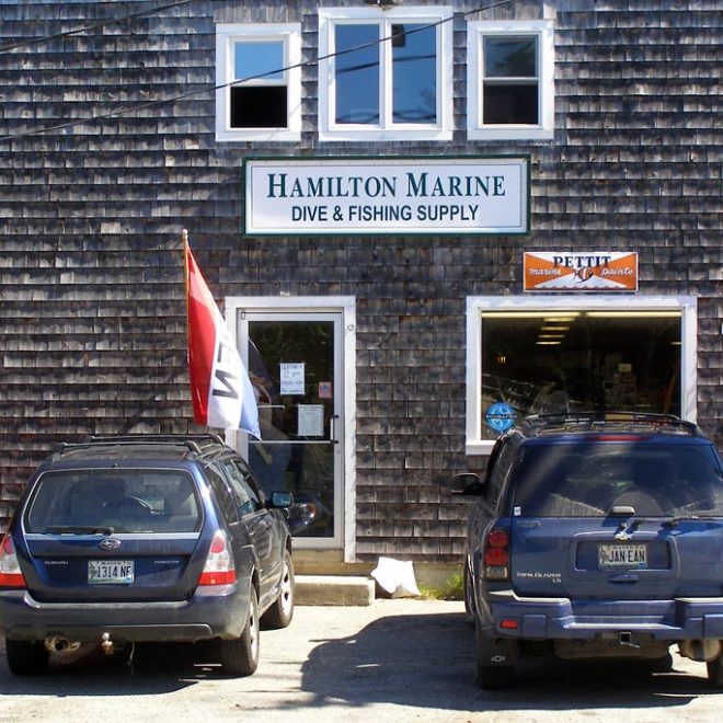
Featured Local Businesses


Boating Resources for Blue Hill Harbor, ME
Important Contacts
Harbormaster in Blue Hill Harbor, ME
Charts, Navigation, & Guides
Online Nautical Chart for Blue Hill Harbor, ME
Pilot Guide Info for Blue Hill Harbor, ME
Important Locations & Services
Weather Conditions & Forecasts
Check Tides in Blue Hill Harbor, ME
Print a Tide Chart for Blue Hill Harbor, ME
Other Resources
FEATURED CONTENT

In The Zone: The Sabre 51 Salon Express
By US Harbors When Sabre Yachts completed construction of hull number 200 of its 48 Salon Express model, more than half the crew who built it had also worked on hull number one. The average tenure on that line was 12 years, and they produced a yacht that proved to… Learn More
Coastal News Updates See All
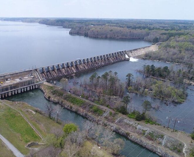
Balancing Energy Production and Aquatic Resources in the Roanoke River
By fisheries.noaa.gov, fisheries.noaa.gov. At the Roanoke Rapids Dam, a hydroelectric facility on the Roanoke River in North Carolina, NOAA Fisheries collaborated with Dominion Energy and partners to evaluate how adjusting the flow of water affects migratory fish and mussel populations in the river. Monitoring results are helping to ensure these… SEE MORE

NOAA’s Use Of Cloud Infrastructure Grows To Include Weather Prediction Models
By noaa.gov, noaa.gov. In the latest innovation to NOAA’s operational weather forecast model technology, the agency announced today that it is moving its high-performance supercomputing operations to the commercial cloud. This transition of NOAA’s Weather and Climate Operational Supercomputing System (WCOSS) supports current and future improvements to NOAA’s suite of… SEE MORE

Gulf Fishery Management: Progress Through Partnership
By fisheries.noaa.gov, fisheries.noaa.gov. From spiny lobster in the Florida Keys to red snapper off the coast of Texas, the Gulf of America’s rich waters support robust recreational and commercial fisheries. In fact, this area leads the nation in recreational landings, generates the second largest commercial landings revenue, and fuels a $20 billion annual fishing economy. A… SEE MORE


