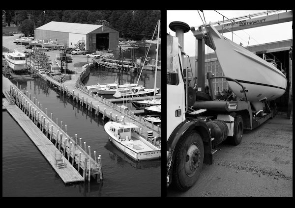
Anchorage
Excellent sheltered anchorage, except from southeasterly to southwesterly winds, may be found in Southwest Harbor in depths of 6 to 50 feet. Deep-draft vessels can anchor midway between Greening Island and the southern shore in depths of 34 to 50 feet. Smaller vessels can anchor farther in the harbor; the depths shoal gradually to 12 feet at a point 100 yards eastward of the islet near the head of the harbor.
The village of Southwest Harbor is on the north side and at the head of Southwest Harbor. The town Harbormaster, Adam Thurston, supervises moorings in the harbor and can be reached on VHF Channel 16 and by calling 207-244-7913.
Two dredged anchorages are in the northwestern part of Southwest Harbor off the wharves northwestward of Clark Point. In 1996, the available depths were 9½ feet in the lower anchorage, thence 5½ feet in the upper anchorage except for shoaling to bare in the south corner.
Wharves
Southwest Harbor Coast Guard Base wharf on Clark Point, on the north side of Southwest Harbor, has a reported depth of 15 feet alongside. The lower town wharf at Clark Point, close westward of the Coast Guard wharf, has three floats, at which there is a reported depth of 12 feet at the outer end. The upper town landing, about 0.3 mile westward of Clark Point, has float landings with depths of 4 to 6 feet reported alongside. The mail and passenger ferry also calls at this landing. There are other commercial and private wharves, some with float landings, on the north side of the harbor with depths of 4 to 15 feet alongside. Gasoline, diesel fuel, water, limited marine supplies, and electronic repairs are available at the wharves.
Services
A shipyard, between the two town facilities, can make hull, engine, electrical, and electronic repairs. A marine railway at the yard can handle craft up to 100 feet; a 25-ton crane is also available.
A large wharf/marina is on the west side of the harbor. Fuel, water, limited repairs and services are available. Boats up to 150 feet are accommodated.
Manset
The village of Manset is on the south side of Southwest Harbor. The town pier is about 0.5 mile westward of Kings Point, the southern entrance point to the harbor; depths of 5 feet are reported alongside the pier’s float landing. A marina, about 0.1 mile eastward of the town pier, has a reported depth of 3 feet alongside its float landing at which gasoline and water are available. A 2½-ton fixed lift, covered winter storage, and marine supplies are available at the marina; hull and engine repairs can be made. The large boatyard, about 0.15 mile eastward of the town pier, has moorings, diesel fuel, water, ice, and a marine railway that can handle craft up to 70 feet for hull, engine, and electronic repairs. A 35-ton mobile lift and open winter storage are also available at the yard. Depths of 10 feet are reported alongside the yard’s service float. There are several commercial marine facilities eastward of the town pier, and numerous private wharves and float landings westward of the town pier.
Navigation:
Click the “Map View” button above to see a chart of this harbor.
Greening Island, on the north side of the entrance to the harbor, is low and wooded. Several houses are visible on the island, and a large house at the eastern end is prominent. Shoals that border the island on all sides are marked on the southeastern and southwestern ends by buoys. Several private piers with float landings are on Greening Island, and three private boathouses with marine ways are conspicuous.
Eastern Way, a well-marked channel approaching Southwest Harbor northward of Sutton Island, is deep and the recommended route for deep-draft and low-powered vessels. This passage is used by all vessels entering Southwest Harbor from the northward in Frenchman Bay and by most vessels entering from the eastward and southeastward.
Gilley Thorofare, the channel southward of Sutton Island, has unmarked rocks with cleared depths of 13 to 18 feet. Spurling Rock, covered 7 feet, on the south side of the channel about 0.3 mile off the northeastern end of Great Cranberry Island, is marked by a bell buoy to the northward. This passage has been examined by means of a wire drag. With the aid of the chart it is easy to navigate in the daytime, but in hazy weather it should be avoided by all vessels.
A small islet, about 400 yards from the head of Southwest Harbor, is marked by a daybeacon.
