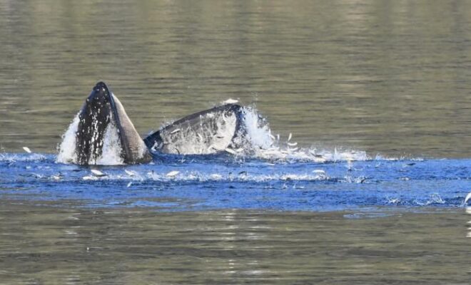
A humpback whale feeds on schooling forage fish in Prince William Sound Alaska. Photo taken under NOAA Fisheries Permit #24378 Credit: NOAA Fisheries/John Moran

Capelin: a “Sea Canary” for Marine Ecosystem Change in Response to Heatwaves

5/27/2026 - By fisheries.noaa.gov, fisheries.noaa.gov. Capelin are a major forage fish species in high-latitude marine ecosystems. Recent heatwaves in Alaska led to a dramatic decline in capelin abundance, which can have major impacts on predators, including marine mammals, seabirds, and fish. Twenty years ago, Dr. George Rose with Memorial University of Newfoundland called capelin… SEE MORE
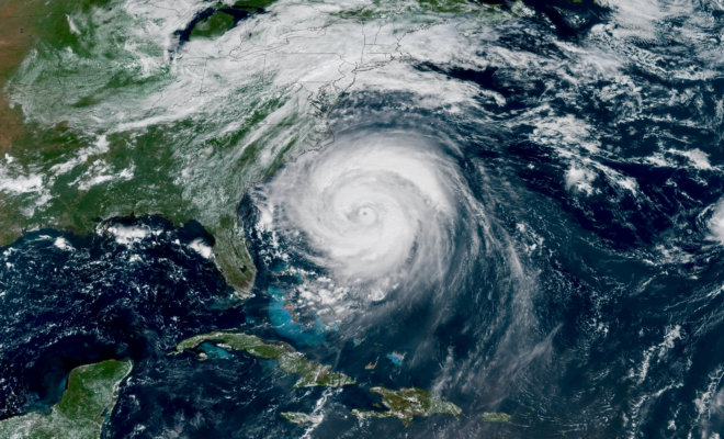
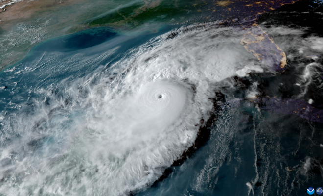
A NOAA satellite view of a massive Hurricane Erin churning off the U.S. East Coast taken August 20, 2025. (Image credit: NOAA Satellites)

NOAA Predicts Below-Normal 2026 Atlantic Hurricane Season

5/25/2026 - By noaa.gov, noaa.gov. Early preparation essential to staying safe all season. Forecasters with NOAA’s National Weather Service are predicting a below-normal hurricane season for the Atlantic basin this year. NOAA’s outlook for the 2026 Atlantic hurricane season, which runs June 1 to November 30, predicts a 35% chance of a… SEE MORE
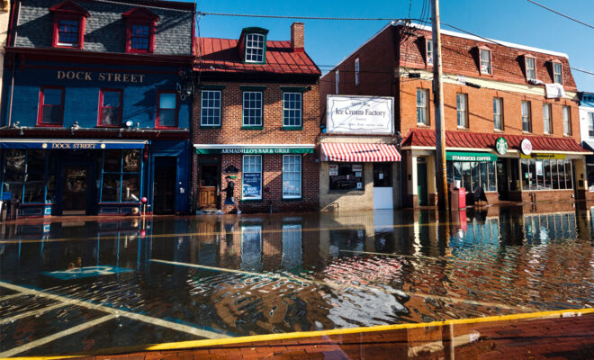
High-tide flooding on October 24, 2017, submerged roads and parking areas along Dock Street, in the historic heart of Annapolis, Maryland. Photo by Will Parson, Chesapeake Bay Program. Used with permission.

El Niño and High Tide Flooding, a Possible Double Whammy for Some Coastal Communities in 2026

5/24/2026 - By oceanservice.noaa.gov, oceanservice.noaa.gov. NOAA’s National Weather Service is predicting El Niño is likely to emerge by July 2026 and continue through the winter, and for many locations in the U.S. this could mean more high tide flooding. To understand why more flooding is expected, it helps to understand what El Niño is and… SEE MORE
Aviation Weather Center monitors showing the tools used for weather forecasting.

NOAA improves aviation forecasts to bolster U.S. air travel efficiency, safety

4/14/2026 - By noaa.gov, noaa.gov. Passengers, pilots, and crew: Get ready for greater peace of mind. Starting in late March, a new NOAA weather forecast system will provide improved prediction of two aviation hazards that pose threats to flight safety and create anxiety among passengers: airplane icing and turbulence. Covering the contiguous… SEE MORE
A carpet of colorful (mostly yellow and orange) wildflowers in California with red-toned mountains in the distance. Wildflowers bloom at Carrizo Plain National Monument on March 12, 2026, in Santa Margarita, California. California’s deserts and hills are seeing a colorful wildflower bloom this spring after a wet winter. (Image credit: Getty Images)

Spring Outlook: Drought Forecasted to Expand in U.S. West, Parts of Plains

4/11/2026 - By noaa.gov, noaa.gov. Drought conditions are forecast to worsen or develop for many areas in the West and south-central Plains, according to NOAA’s Spring Outlook released today for April through June. Forecasters from NOAA’s National Weather Service also predict above-normal temperatures for the majority of the U.S. “Factors influencing NOAA’s Spring Outlook include… SEE MORE
Image of Hurricane Milton from NOAA's GOES-16 satellite on Oct. 8, 2024. (Image credit: NOAA)

National Hurricane Center to Issue New Forecast Cone Graphics for 2026 Hurricane Season

4/10/2026 - By noaa.gov, noaa.gov. Other product enhancements include Hawaii Storm Surge Watches & Warnings As part of a suite of product improvements for the 2026 hurricane season [PDF], NOAA’s National Hurricane Center (NHC) is implementing two new tropical products and services: a new operational hurricane track cone map, and new storm surge alerts… SEE MORE
A Bering Sea pollock fleet prepares to depart Dutch Harbor, Alaska, for another season of the largest commercial fishery in the United States. (Image credit: S. Zmolek/NOAA)

NOAA Strengthens Commitment to World-Class Tsunami Monitoring and Detection in Pacific

4/2/2026 - By noaa.gov, noaa.gov. National Mesonet Program ensures seismic detection continues to operate in real time A new agreement between NOAA, the Alaska Mesonet and the seismic network operated by the University of Alaska-Fairbanks Alaska Earthquake Center (UAF AEC) is funding nine AEC-owned seismic stations that support near-real-time tsunami threat information.… SEE MORE
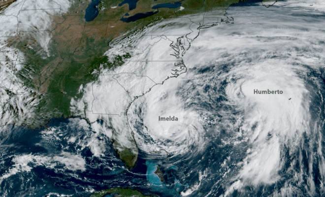
NOAA’s GOES-19 satellite captured images of hurricanes Imelda (left) and Humberto (right) churning off the U.S. East Coast on Sept. 30, 2025. (Image credit: NOAA Satellites)

2025 Atlantic Hurricane Season Marked by Striking Contrasts

11/30/2025 - By noaa.gov, noaa.gov. Seasonal activity fell within NOAA’s predicted ranges The 2025 Atlantic hurricane season, which officially ends on November 30, was notable for its striking contrast — wavering between periods of relative calm and bursts of intense activity, generating very powerful storms. Overall, the season fell within the predicted ranges… SEE MORE
Image Credits: NOAA.

Hurricane Erin Demonstrates Critical Maritime Coordination for Port Safety

9/16/2025 - Hurricane Erin demonstrated how proactive federal coordination successfully protected East Coast ports and maritime traffic from distant storm threats. [caption id="attachment_51392" align="aligncenter" width="2560"] Image Credits: NOAA.[/caption] In “Hurricane Erin Demonstrates Critical Maritime Coordination for Port Safety” NOAA, published in noaa.gov. (Sep 10, 2025), it is stated: Hurricane Erin's passage near… SEE MORE
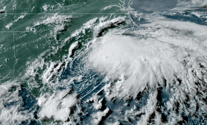
Image Credits: NOAA.

Prediction Remains on Track for Above-Normal Atlantic Hurricane Season

8/19/2025 - By noaa.gov. As the 2025 Atlantic Hurricane Season enters its historical peak, atmospheric and oceanic conditions continue to favor an above-normal season as NOAA first predicted in May. Forecasters from NOAA’s National Weather Service updated the number of expected named storms to 13-18 (with winds of 39 mph or greater), of which… SEE MORE