Search for More News:
NOAA Sargassum Tool Now Provides Daily Update of Risk of Seaweed Washing up on Beaches
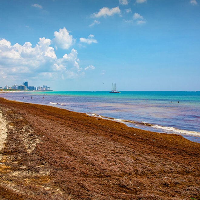
By research.noaa.gov, research.noaa.gov. Upgrade will help communities anticipate impacts, risks, and supports planning and response. NOAA’s Sargassum Inundation Risk tool (SIR) has been upgraded to offer daily reports on the location and risk that brown floating algae could wash ashore along coastal areas in the Caribbean, Florida, Gulf of America, and northern… SEE MORE
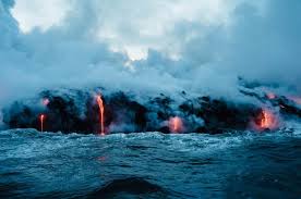
Three Ocean Robots Exploring Active Underwater Volcanoes
By Amelia Macapia, whoi.edu. The ocean floor is home to thousands of volcanoes — many of them active — and understanding what's happening down there requires machines that can go where humans can't. A new feature from WHOI's Oceanus magazine profiles three robotic vehicles that are transforming what scientists know… SEE MORE
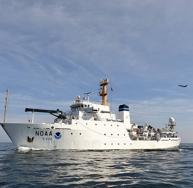
NOAA Ship Thomas Jefferson Returns to the Great Lakes
By oceanservice.noaa.gov, oceanservice.noaa.gov. Survey work will map areas for the first time since the 1940s. For the first time since 2022, the NOAA Ship Thomas Jefferson is underway in the Great Lakes. The vessel and its crew of NOAA Corps officers and professional mariners are working with NOAA scientists to map the… SEE MORE
WHOI Scientist Hunts for 10-Million-Year-Old Ice in Antarctica
By Evan Lubofsky, whoi.edu. Ancient ice buried beneath Antarctica holds trapped air bubbles that serve as tiny time capsules of Earth's atmosphere — and a WHOI geoscientist is pushing the record further back than ever before. Sarah Shackleton, who helped recover 6-million-year-old ice cores from Antarctica's Allan Hills in 2023,… SEE MORE
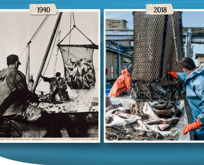
Magnuson-Stevens Act at 50: Charting a Course to Sustainable Fisheries
By fisheries.noaa.gov, fisheries.noaa.gov. This landmark legislation set the United States on track to become a world leader in sustainable fisheries management. In April, we celebrated the 50 years since the United States signed the Magnuson-Stevens Act. This landmark law set the United States on a course toward sustainably and cooperatively managed marine… SEE MORE
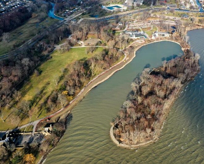
Restoring Habitat for Great Lakes Fish at the Historic Edsel and Eleanor Ford Estate
By fisheries.noaa.gov, fisheries.noaa.gov. With $7 million in funding from NOAA Fisheries, the Ford House estate on Lake St. Clair in Michigan is rebuilding shoreline habitat for fish and other wildlife while expanding access and educational opportunities for visitors. NOAA Fisheries’ Office of Habitat Conservation has established a unique partnership with Ford House, the… SEE MORE
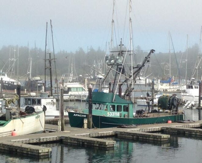
New System Maps and Charts West Coast Fisheries Data to Inform Decisions on Ocean Uses
By fisheries.noaa.gov, fisheries.noaa.gov. A new system combines decades of fisheries data and statistics to visualize West Coast fisheries and how they have changed over time. The Pacific Fishing Effort Mapping Project was led by researchers at NOAA, state wildlife departments, and the Pacific States Marine Fisheries Commission. It consolidates location… SEE MORE
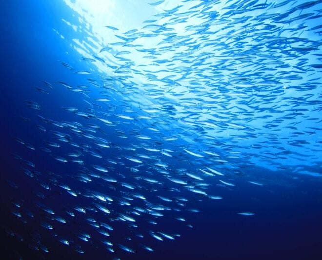
United States Pushes for Stronger Action to Fight Illegal Fishing and Sustainably Manage Fisheries in the North Pacific
By fisheries.noaa.gov, fisheries.noaa.gov. The United States advanced its goals to combat harmful fishing practices at the North Pacific Fisheries Commission’s 10th annual meeting in Osaka, Japan, in April. The Commission is a regional fisheries management organization. It manages pelagic and deep-sea fisheries in the high seas of the North Pacific, other than… SEE MORE
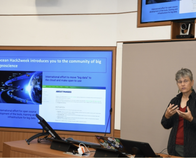
Breaking Barriers to “Big Earth Data”
By fisheries.noaa.gov, fisheries.noaa.gov. Dr. Elizabeth "Eli" Holmes received the prestigious Earth Science Information Partners Martha Maiden 2026 Award in January. Dr. Holmes’ 25-year career at NOAA Fisheries demonstrates a deep commitment to advancing open science, fostering collaboration across agencies, and inspiring the next generation of scientists. At NOAA’s Northwest Fisheries Science Center, Dr.… SEE MORE
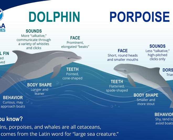
Is It a Dolphin or a Porpoise?
By fisheries.noaa.gov, fisheries.noaa.gov. Dolphins and porpoises are both cetaceans, but they have distinct characteristics that set them apart. Learn how to recognize a dolphin vs. a porpoise. Dolphins and porpoises, along with whales, belong to a group of marine mammals called “cetaceans.” Cetacean comes from the Latin word for “large… SEE MORE
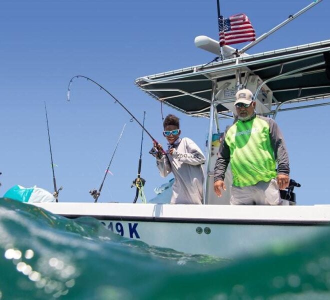
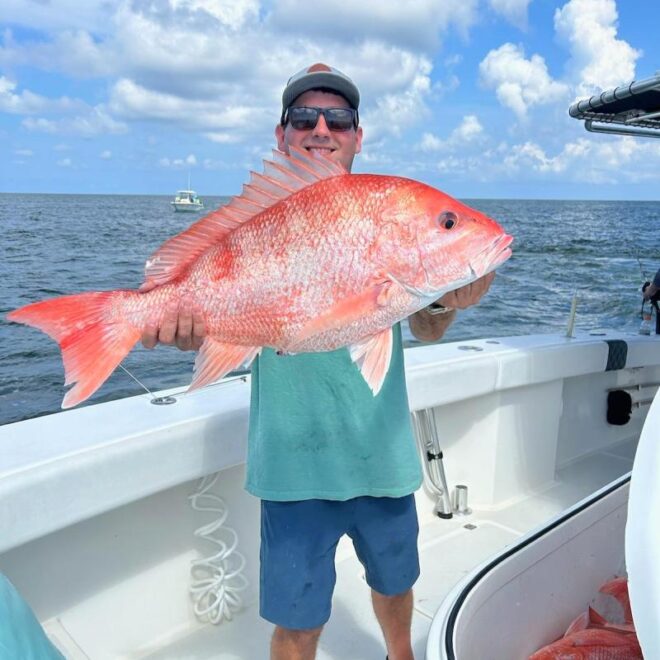
Future of the Catch: The Modernization of Recreational Red Snapper Data Collection
By fisheries.noaa.gov, fisheries.noaa.gov. NOAA Fisheries and partners are using innovative methods to modernize Gulf of America recreational red snapper data collection. These projects are working to deliver faster, more efficient science. Red snapper is a cultural and economic cornerstone for coastal communities in the Gulf of America. The species is… SEE MORE
NOAA Fisheries Certifies Two State Recreational Fishing Surveys to Improve Catch Estimates
By fisheries.noaa.gov, fisheries.noaa.gov. NOAA Fisheries has certified Alabama’s and Mississippi’s creel surveys as part of a move to advance federal-state partnerships for recreational fisheries management strategies. These surveys aim to produce more timely and precise estimates of state-specific recreational fishing catch and trip activity. This certification marks a significant milestone in the… SEE MORE