Search for More News:
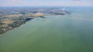
Moderate Harmful Algal Bloom Predicted for Western Lake Erie
By noaa.gov, noaa.gov. NOAA and its research partners are forecasting a moderate harmful algal bloom (HAB) in western Lake Erie this summer. This year’s bloom is expected to measure 3.5 on the HAB severity index, with a potential range of 3 to 4.5. “Toxic algae affect not only the health… SEE MORE

2026 Best Harbor Contest Winners Announced!
Padanaram, South Dartmouth, MA Wins Best Harbor Padanaram, Massachusetts is the Grand Winner, Best Harbor in the U.S. for 2026 Boaters and coastal enthusiasts in Padanaram, South Dartmouth, Massachusetts, got out the vote this year to take the prize as our Grand Winner, returning to the top spot in US… SEE MORE

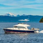
A Tale of Two Gulf of Alaska Crossings: Yacht and Tugboat
By Norris Comer, best4boats. The Gulf of Alaska is one of those bodies of water that commands respect from anyone who's crossed it — or plans to. In a vivid first-person account for Best4Boats, editorial director Norris Comer recounts two very different passages across the gulf: one aboard a 1965… SEE MORE
7 Ways El Niño and Large Marine Heatwave Could Affect West Coast Marine Species
By fisheries.noaa.gov, fisheries.noaa.gov. A large marine heatwave has bathed parts of the West Coast in very warm ocean waters over the past year, breaking temperature records in the Pacific. NOAA has also announced that El Niño has developed in the tropical Pacific and is predicted to intensify to a moderate or strong level this… SEE MORE

Meet The Great Marsh Shellfish Company, Oyster Growers in Massachusetts
By fisheries.noaa.gov, fisheries.noaa.gov. When you farm shellfish on Massachusetts’ beautiful coastal marshes, the world is your oy-stah! At least according to Brenden Doyle, a Gloucester native with family roots in Massachusetts’ commercial and recreational fishing industry. He spent his childhood boating and fishing around Cape Ann and learning about the… SEE MORE

Celebrate National Fishing and Boating Week!
By fisheries.noaa.gov, fisheries.noaa.gov. Marine recreational fishing is a cherished American pastime and draws millions of anglers to support our coastal communities. Celebrate our nation's love for fishing and boating during National Fishing and Boating Week. Cast a line and join anglers across the country in celebrating National Fishing and Boating… SEE MORE

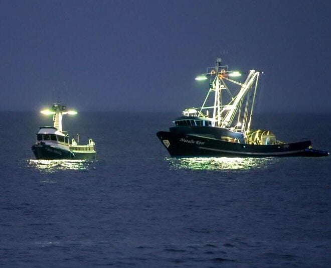
NOAA Fisheries Announces $2.3 Million to Study Atlantic Mackerel with the Northeast Fishing Industry
By fisheries.noaa.gov, fisheries.noaa.gov. NOAA Fisheries is beginning a cooperative research initiative, partnering with the Northeast fishing industry to learn more about Atlantic mackerel population dynamics. The initiative will receive $2.3 million in the current fiscal year. The project will engage more than 50 fishing vessels to collect and analyze data… SEE MORE

Reconnecting Rivers Boosts Oregon Coast Coho Recovery
By fisheries.noaa.gov, fisheries.noaa.gov. NOAA Fisheries supports one of the most ambitious salmon restoration projects on Oregon’s coast: the Salmon SuperHwy. This partnership of more than a dozen organizations works across the Tillamook, Nestucca, and Sand Lake watersheds. It works to restore fish passage at dozens of stream barriers, such as failing… SEE MORE
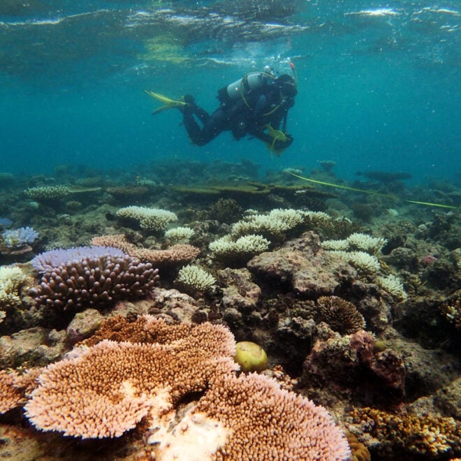
WHOI Develops Tool to Predict Coral Bleaching Months Before It Strikes
By whoi.edu, whoi.edu. A new forecasting tool from Woods Hole Oceanographic Institution could give reef managers and coastal communities a five-to-six-month head start on one of the ocean's most destructive events: coral bleaching. Called the Bleaching Event Early Predictor (BEEP), the system works by tracking three large-scale climate patterns in… SEE MORE
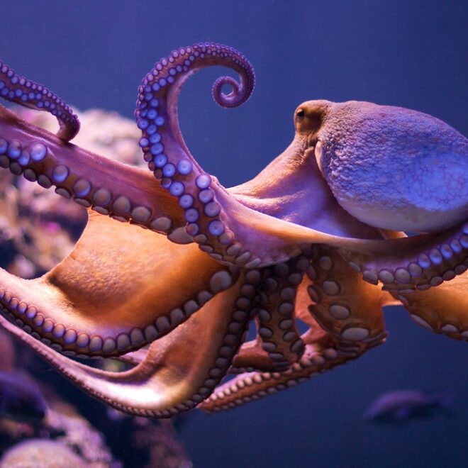
Remarkably Bright Creatures: A Story of Octopus Intelligence Set in the Pacific Northwest
By Janet Green Hammerman, best4boats.com. The Netflix adaptation of Shelby Van Pelt's bestselling novel Remarkably Bright Creatures is drawing renewed attention to one of the ocean's most fascinating inhabitants — the giant Pacific octopus. Set in a fictional Pacific Northwest coastal town, the story follows an aging widow, a drifting… SEE MORE
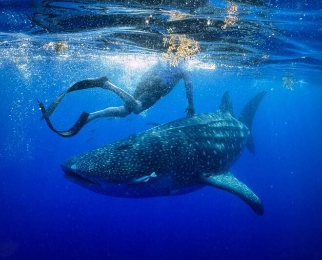
A Year in the Life of Larry the Whale Shark
By fisheries.noaa.gov, fisheries.noaa.gov. One year ago today, researchers deployed a satellite tag on a whale shark off the coast of Tampa Bay, Florida. They never could have anticipated the epic journey that would ensue. On May 28, 2025, researchers set out from Boca Ciega Bay, Florida, heading into the Gulf… SEE MORE
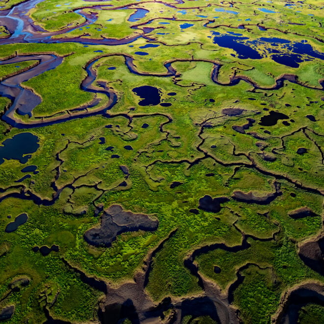
The Coast Is Clear-er: NOAA Unveils New Land Cover Maps 900 Times Greater In Detail
By noaa.gov, noaa.gov. NOAA is releasing new, higher-resolution land cover maps for coastal Alabama, Mississippi, Northeastern Ohio, Rhode Island, and the Puget Sound in Washington. The data will be made available through the Digital Coast website and will provide these communities with better information for decisions related to stormwater management, water quality… SEE MORE